Showing posts with label police. Show all posts

Wednesday, April 24, 2024

Aloft Introduces Automated SGI Waivers in Aloft Air Control, Streamlining Access to Restricted Airspaces

 Aloft Technologies, Inc. (Aloft), a leader in advanced drone software solutions, is thrilled to announce the integration of Automated Special Government Interest (SGI) Waivers into its Aloft Air Control platform. This new feature is set to revolutionize how drone operators access restricted airspaces, significantly enhancing operational efficiency and compliance with federal regulations.


Automated SGI waivers are available today for all Aloft Air Control enterprise customers.

The Automated SGI Waivers functionality simplifies the complex and time-consuming process of obtaining necessary permissions for drone operations in sensitive or restricted areas. This development reflects Aloft’s ongoing commitment to innovation and its dedication to supporting the operational needs of its clients across various industries, including public safety, emergency response, and infrastructure inspection.

Jon Hegranes, CEO and Founder of Aloft, commented on the new feature, saying, “We understand the critical nature of time-sensitive operations, especially in scenarios that involve public safety and emergency responses. Integrating Automated SGI Waivers into Aloft Air Control not only streamlines the approval process but ensures that our clients can deploy their drones quickly and legally, even in the most restricted airspaces. This capability is about empowering our users to focus more on their mission-critical tasks and less on bureaucratic hurdles.”

The Automated SGI Waivers are designed to interact seamlessly with existing features within the Aloft Air Control ecosystem, providing a comprehensive solution for airspace management that includes pre-flight planning, real-time traffic alerts, and post-operation analysis. This integration ensures a smooth, intuitive user experience and upholds the highest safety and compliance standards.

Key benefits of the Automated SGI Waivers include:

-Reduced Approval Times: Drastically cuts down the waiting period for gaining airspace access, facilitating rapid response and operational readiness.

-Enhanced Compliance: Ensures that all drone flights are compliant with current FAA regulations, minimizing legal risks and enhancing public safety.

-Streamlined Operations: Integrates with the overall flight management system to provide a unified workflow from planning to execution.

This innovative feature is expected to set a new benchmark for operational efficiency in drone technology, reflecting Aloft’s role as a pioneer in the industry. With one click, users can transform an existing mission in Aloft into an auto-generated SGI form ready to email to the FAA’s SOSC Office.

For more information about Automated SGI Waivers and Aloft Air Control, please email sales@aloft.ai or contact your Aloft customer success representative.

About Aloft Technologies, Inc.:
Aloft Technologies, Inc. specializes in developing advanced drone software solutions, empowering businesses and government entities to manage their drone operations with enhanced efficiency, safety, and compliance. Based in Syracuse, NY, Aloft continues to lead the way in airspace and fleet management technology. Aloft’s UTM network and Air Control platform is utilized by hundreds of government and public safety agencies.

Monday, July 10, 2023

4 rescued from Yellowstone River near Billings

Emergency response teams in Billings joined forces in a highly effective multi-agency water rescue operation, resulting in the safe recovery of four individuals on Sunday night. This collaborative effort demonstrated the exceptional coordination and utilization of advanced technology to respond to water emergencies.


On July 9, 2023, emergency services responded to a distress call reporting a water emergency involving multiple individuals in the Yellowstone River near South West Billings at 8:59 p.m. The Billings Fire Department, the Yellowstone County Sheriff's Office, AMR, and additional fire units swiftly arrived at the scene, ready to provide assistance.

The incident commander immediately initiated a well-coordinated response, with each agency utilizing their specialized resources and expertise. The Billings Fire Department's drone team played a critical role in the operation by deploying an unmanned aerial vehicle equipped with an infrared (IR) camera. The IR technology proved invaluable in locating the stranded victims, even in challenging conditions of darkness.

In the first phase of the operation, the swift water rescue team from the Billings Fire Department successfully executed the rescue of an individual stranded on a tree in the middle of the river around 9:30 p.m. Simultaneously, responders focused their efforts on the rescue of three additional individuals who were stranded on an island in the river. These rescues spanned from 10 p.m. to 11:30 p.m. The Sheriff's Office Rescue Boat, operated by the Sheriff's Office and supported by swift water technicians from the Billings Fire Department, navigated the challenging waters and facilitated the safe recovery of the individuals.

This incident highlights the inherent risks associated with water activities, particularly in rivers, and serves as a reminder for all individuals engaging in such activities to prioritize their safety. The Billings Fire Department urges everyone to wear a properly fitting and U.S. Coast Guard-approved life jacket, as it significantly increases the chances of survival during water emergencies. Additionally, individuals should inform a trusted person about their plans, including the intended location, expected return time, and any changes to the itinerary, to facilitate a swift response in case of an emergency.

The individual stranded in a tree had an inexpensive raft that flipped and she then became tangled in a tree.

The second set of victims were looking for their friend and got stranded on the island.

The successful outcome of this water rescue operation was a testament to the joint efforts and seamless collaboration between the Billings Fire Department, the Yellowstone County Sheriff's Office, AMR, and other supporting agencies. Their commitment to public safety, coupled with the utilization of advanced technology, contributed to the successful recovery of all four individuals involved.

Victoria Hill, the public information officer for the City of Billings:


Wednesday, March 15, 2023

Public Safety and Law Enforcement Toolkit


This toolkit is designed to assist law enforcement and public safety entities in operating and handling situations involving drones or UAS.

Webinar: Drone Safety: It's the Law
The use of drones in our nation's airspace is rapidly increasing, which raises both opportunities and challenges for public safety and government officials. Learn more about how your authority allows you to take action and respond to unauthorized or unsafe drone operations. Watch the webinar.

Advisory Circular (AC) 00-1.1B
Government or government-contracted aircraft operations must obtain COA from the FAA prior to operations.
Advisory Circular 00-1.1B, Public Aircraft Operations

Small UAS Rule Part 107
This rule contains safety regulations for drones weighing less than 55 pounds.
Summary of the Part 107 Rule (PDF)
Fly under the Small UAS Rule
Advisory Circular 107-2 (PDF)

The Exception for Recreational Flyers
People who fly their drone, UAS, or model aircraft for fun are considered recreational flyers.
Recreational Flyers & Modeler Community-Based Organizations
Authorization for limited recreational operations as described in section 44809 (PDF)
Advisory Circular 91-57B – Exception for Limited Recreational Operations of Unmanned Aircraft

Mobile Apps
The FAA's B4UFly App assists users in determining where they can and can't fly. Law enforcement and public safety agencies can use it to determine where they can operate drones or whether drone operations are authorized in a specific location or not.

Public Safety Small Drone Playbook

Drones are being safely integrated into our national airspace for recreational, commercial, and public safety uses. However, unauthorized operations can cause potential hazards to people and property both in the air and on the ground. Our Public Safety Small Drone Playbook is intended to be used as an informational resource for public safety officials conducting investigations regarding drones. The Playbook can assist in determining the difference between authorized and non-authorized drone operations and what potential actions public safety might take.


Tuesday, March 14, 2023

First, in the Nation – Pearland PD expands DFR operations to include BVLOS without Visual Observers


Pearland Police Department has been awarded a certificate of authorization (COA) to operate its drone as first responder (DFR) program beyond visual line of sight (BVLOS) operation, eliminating the need for human visual observers (VOs). This was achieved using Iris Automation’s Casia G ground-based air surveillance system. 

Read More; SUAS News

Monday, January 9, 2023

11 ways police departments are using drones


 There is a paradigm shift occurring in law enforcement as drones become a critical element in almost every aspect of emergency operations

As drones continue to evolve, law enforcement agencies around the world are using them in more ways to save lives and enhance the safety of officers.

Drones have had a major impact in the areas of traffic crash reconstruction, reconnaissance before tactical deployments, SWAT overwatch, hostage situations, forensic investigations, patrol-deployed operations, searches for lost persons, tethered operations, traffic pattern evaluation and first response. Let's take a look at these specific applications.

Read More; Police 1

Friday, July 24, 2020

Drones and Image Analysis Help Locate Gravesites


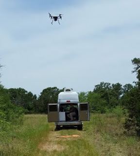
Loc8 is pleased to announce that it will be collaborating with Texas State University and the University of Missouri on a $280,000 grant to utilize drones to locate human remains and detect clandestine graves. This grant, which was awarded by the National Institute of Justice (NIJ), continues the groundbreaking research conducted in 2015 by Gene Robinson, president of GRC Consulting, and the Texas State Anthropology Department.

drone, uas, uav, grave, human, remains, nij,

Dr. Daniel Wescott of the Forensic Anthropology Center at Texas State states that this two-year project is challenged with documenting the ways drone technology and their payloads (various multispectral cameras) can be used and how it differs with traditional ground-based studies. Loc8 is collaborating with the project to bring its patent-pending image analysis algorithms into the field of aerial forensic science.

Pilot for the NIJ project Gene Robinson stated, “The ability of Loc8 to scan down to the individual pixel level in each image is going to change the way remote sensing is used in search and rescue (SAR) missions and crime scene investigations. The Loc8 software has only been available since 2019 and we have already realized successes in the field. We are just now scratching the surface in the different ways Loc8’s image analysis algorithms can be used.” The NIJ project is slated to handle a wide array of remote sensors from standard RGB, to near infrared (NIR), to thermal (FLIR) and multi-spectral imagery to detect subtle changes in the environment resulting from human remains on or under the ground from the vantage point of a deployed drone.

The NIJ Grant project data collection flights began in late January 2020. Over the next two-years, the flights are scheduled to continue on a near daily or weekly basis depending upon the stage of the study. The research is being conducted in the Texas State University’s 26-acre open-air forensic laboratory. Under the NIJ project, eight to ten science pledged body donation volunteers (cadavers) will be studied under various scenarios designed to mimic ground conditions of undiscovered clandestine sites. The University of Missouri is tasked with the image/data analytics and will act as the repository for all the data collected.

Robinson added, “The Texas State Forensic Anthropology Research Facility replicates conditions and environments of some of the tough cases we have encountered in the past 15 years. We can really bring the current technology to bear in a scientific way that will be a tremendous benefit to both law enforcement and the search and rescue community.”

The research has already begun at the Texas Hill Country facility and will simulate different environments and seasonal effects on the forensic investigative process. The project will identify best practices for drone utilization, determine the most effective sensors, and explore the advantages of using an image analysis software like Loc8 to enhance the effectiveness and thoroughness of the search and rescue or recovery investigative process.

As part of the NIJ Project, Gene Robinson will be cataloging the changes in the color palettes of the volunteer subject’s skin, soft tissue, and skeletal remains during the natural decomposition process. These color palettes will then made available as sample data sets for Loc8 subscribers to use during their search and rescue/recovery missions. The Human Remains color palette dataset is one of many datasets Loc8 is developing to assist subscribers.

Loc8 (www.loc8.life) is a patent-pending image scanning technology that analyzes the individual pixels in a digital image (still or video) by searching for colors that match a userdefined color palette. Once the defined pixel color(s) are detected in the scanned images, Loc8 reports the latitude, longitude, and the altitude of the geographical location of the detected item(s).

Loc8 was originally developed to scan digital images (still or video) quickly and thoroughly collected during search and rescue/recovery (SAR) missions. However, since its release, the Loc8 algorithm has been tested as a tool in crime scene investigation, accident reconstruction, debris field mapping, precision agricultural management, wildlife population management, and utility infrastructure inspections, to name a few of the many potential applications.


Saturday, June 6, 2020

Cops Releases New Report On The Use Of Drones In Policing


A Report on the Use of Drones by Public Safety Agencies—and a Wake-Up Call about the Threat of Malicious Drone Attacks

The Community Oriented Policing Services (COPS) division of the Department of Justice recently released their report on the use of drones in policing. There’s a lot of good information here for police departments, broken into 3 sections: Pre-Implementation Considerations; Establishing a Drone Program; and Malicious Use of Drones. In particular the report is geared toward helping departments maintain transparency and communication with the community about the use of drones. Read More.


Wednesday, April 8, 2020

Daytona Beach Police Using Drones To Enforce Coronavirus Closures

ClickOrlando.com April 7, 2020
DAYTONA BEACH, Fla. – The Daytona Beach Police Department is now equipped with two more drones to add to its six, but the loaner drones police are using to enforce closures and other social distancing measures during the coronavirus pandemic are equipped with intercoms.

police, drone, uas, uav, covid-19, coronavirus, daytona,

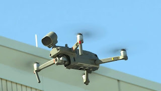
Drone company DJI loaned the drones to the department through a disaster relief program. Police said the flying pieces of equipment will help them disperse crowds and keep people out of all city parks, which are temporarily closed to help prevent the spread of COVID-19.

“We’re reducing the officer having to go out there, walk into the park property, walking into a crowd of people, share those germs back and forth just to deliver a message that, 'The park’s closed. Don’t be in here,’” said Sgt. Tim Ehrenkaufer, who heads the department’s Unmanned Aviation Systems Unit.

The department showed drone footage from one of its 30 missions over the last week. The video shows people leaving parks throughout the city and Ehrenkaufer said people fully complied. Police also demonstrated their own $27,000 drone that’s equipped with a drop hook feature that officers use in situations similar to when a beachside bomb threat was reported last year. Ehrenkaufer said it’s also helpful to drop off lifesaving materials.

“That could be anything from the life preserver that you’ve seen us drop into the lake, to somebody drowning, to a box of gloves, medication,” he said.

That same drone also has a FLIR cam that can read a person’s body temperature. Police said they will be discussing if it should be installed in their front lobby to help minimize the spread of COVID-19.

“Let’s say if you have a 103 fever, that will come in handy with letting us know from at a glance, are you somebody who possibly has the virus?" Ehrenkaufer said. "Do we need to make sure you have extra precautions and make sure that you have the extra equipment that you need?”

The department hopes the two loaner drones will officially be theirs in the future because it could possibly be another protective layer for an officer's safety.

“I think in terms of keeping officers safe, I think it’s very important,” Ehrenkaufer said.

Sunday, April 5, 2020

Anchorage Police use drone to find missing hiker

KRCR TV  April 5, 2020
Police in Anchorage, Alaska, deployed a drone to help them locate a hiker who had gone missing in a wooded area on Saturday, March 28.

According to police, dispatchers received a call from a woman who went off-trail in a wooded area and was no longer able to see her footprints in windy conditions.

Police sent officers who were in the area to find the woman on foot, while another officer sent up the drone. Once deployed, the drone located the woman within 15 minutes, using an infrared camera. The drone officer was able to tell the woman his colleagues were on the way. “She was really happy to hear the mysterious voice in the sky,” police added.

“All’s well that ends well! We got her out safe and sound,” police wrote.  See video


Do you have a story of drones coming to the rescue or assisting your agency?  Please share in the comments.

Friday, April 3, 2020

First Responders Assess Drones for Search and Rescue Missions

Drones buzz like bees, hover like hummingbirds, and accelerate like race cars. Besides being used for play, drones, properly known as unmanned aircraft systems (UAS), have quickly become vital pieces of technology for both private and public organizations. First responder organizations rely more and more on them to enhance their response capabilities and better execute their missions. But how can first responders be sure the drones they are buying meet their specific mission needs?

The Department of Homeland Security (DHS) Science and Technology Directorate (S&T) can help.

In November 2019, S&T’s National Urban Security Technology Laboratory (NUSTL) assessed small, commercially available drones for priority needs of first responders through its First Responder Robotic Operations System Test (FRROST) program. The needs were identified by the S&T First Responder Resource Group (FRRG), a volunteer working group of experienced emergency response and preparedness professionals from across the U.S. who guide research and development efforts. The assessment was performed under realistic field conditions at Camp Shelby Joint Forces Training Center in Mississippi.

“We are focused on the first responder community – fire, police, and emergency management departments – and we are assessing small UAS,” said Cecilia Murtagh, FRROST Project Manager. “They are much cheaper than manned aircraft, which makes them an ideal tool for response agencies.”

public, safety, drone, uas, uav, first, responders, dhs,

Background
S&T initiated the FRROST program in 2018 to help the first responder community evaluate drones in real-world field conditions under simulated scenarios to inform their purchases. FRROST is modeled after S&T’s System Assessment and Validation for Emergency Responders (SAVER) Program, managed by NUSTL. It assists emergency responders in making procurement decisions by producing reports based on objective assessments and validations of commercially available technology. FRROST focuses on drone technology and uses assessment methods developed by the National Institute of Standards and Technology (NIST).

In June 2018, a focus group of first responders, experienced in piloting drones for different missions, convened to provide evaluation criteria for the FRROST assessment. The focus group selected several drones to be tested and evaluated in realistic field conditions.

Becoming the ‘right hand’ of first responder organizations
D.J. Smith from Virginia State Police operates the remote control of a Falcon 8+ drone by Intel. Small drones offer tremendous potential for emergency response missions. Thanks to recent technology advances, they have become more effective, more affordable and easier to fly. They can not only keep responders safer, but also provide opportunities for missions impossible for manned aircraft, such as exploring inside buildings and tunnels.

“Drones are a force multiplier for first responders,” said Murtagh. “It gives them eyes on a situation quickly with generally less manpower; for example, you could fly a drone over diverse terrain or wide areas and try to find a lost hiker, which would be labor intensive for field teams.”

Law enforcement responders use drones for tactical operations, building searches, traffic crash investigation, pursuit, and more. For example, the Plano, Texas Police Department used a drone to look for an armed suspect hidden in an apartment complex.

“The subject was actually firing rounds out of the apartment, so we couldn't get close enough to look in,” said Lieutenant Glenn Cavin of the Plano Police Department. “The UAS was able to look through the window and provide intelligence.”

After floods, emergency managers use drones to survey actual damage, so they send help where it is actually needed without risking responders’ lives.

“We have launched our drone to find a missing older adult,” said Randy Frank, Director of Marion County, Kansas Emergency Management. Small counties like Marion use the same drones for multiple missions. “Drone use is only limited to your imagination.”

Large counties like Orange County, California, need different drones for their various terrains, including metro city, wildland-urban boundary, harbors and more.

Tom Haus from the Los Angeles City Fire Department sets up video to capture the operator interface while the participants fly the NIST Test Methods.“During a brush fire, a drone can map out where the hot spots are, thus helping the firefighters to put that hot area out,” said Frank Granados, Firefighter Paramedic at the Orange County Fire Authority, CA.

First responders assessed drones at Camp Shelby
In November 2019, nine first responder drone pilots from across the U.S., some of whom are quoted in this article, assessed four small drones in fields and mock urban settings at Camp Shelby. The drones weighed between 1.9 and 13.5 pounds. The pilots, with law enforcement, firefighting and emergency management backgrounds, participated in three different search and rescue scenarios: lost hiker (in an isolated field), post-flood disaster (in the urban setting and an adjacent field) and a twilight scenario (in the urban setting). The drones demonstrated different capabilities and participants provided feedback to NUSTL after taking turns flying them. NUSTL coordinated with NIST for this testing event, using a test course that NIST developed for drone assessment and pilot training and testing.

“All participants are getting an opportunity to run the drones through those standard test lanes to see how they match up against what they would like to see in a mission ready, small unmanned aerial system,” said Captain Tom Haus of the Los Angeles Fire Department, who assisted NIST with FRROST’s standard testing and scenarios.

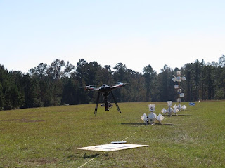
Falcon 8+ drone hovers over a car with a cluster of NIST buckets to look for ‘stranded flood victims,’ as part of the FRROST search and rescue scenario.Wooden stands stood in a wide field next to the urban setting at Camp Shelby. Clusters of white two-gallon buckets like giant bell-shaped blossoms adorned the stands. Other clusters were attached to windows, roofs, and even a car. Inside each bucket on the bottom was a sticker with a letter surrounded by a circle. Such stickers could be seen on other parts of the buckets and poles. The drones had to hover over each bucket, like honeybees over a flower, and take accurate pictures.

“These visual acuity tests, just like the eye charts at the eye doctor, are designed to allow the operator to align his/her small unmanned aerial system with that bucket” said Haus. “If you are not aligned, the bucket itself keeps you from seeing into the bottom.”

Participants assessed how well the drones could be stabilized, how easily they could be flown, and how well their payloads functioned. Payloads included 30x zoom cameras for distant visualization and thermal cameras for twilight and night.

During the twilight testing, drones demonstrated their thermal imaging cameras and participants watched on a monitor what the drone was ‘seeing.’ One of the pilots moved the drone vertically, hovered it over the car, a roof and in front of a window, all with clusters of buckets. This simulated how a drone could be operated to look for survivors after an emergency or disaster, such as a hurricane.  

NUSTL representative Cody Bronnenberg (right) records feedback from UAS Trainer Coordinator Christopher Stockhowe (left) from the Virginia Beach Fire Department after he flew the EVO drone by Autel Robotics.FRROST took place over four days, with a different drone assessed each day. A large drone with a 42-megapixel camera and an infrared camera was tested during the last day. It was designed for professional inspection and surveying of bridges and other areas. The first responder evaluators determined that it could be paired together with a smaller, faster drone. In this scenario, the evaluators used the large drone for overall incident awareness and then used a smaller drone for closer inspection.

Future outlook
The feedback provided by participants in the FRROST event will be documented in a final assessment report and shared nationally with the first responder community. NUSTL’s report will provide unbiased results that can help first responder organizations with their procurement decisions.

Moving forward, another S&T project called Joint Unmanned Systems Testing in Collaborative Environment, or JUSTICE, assesses drones and sensors for the Homeland Security Enterprise. JUSTICE is managed by the S&T Air Based Technologies Program and a team of experts from the Mississippi State University Raspet Flight Research Laboratory.

“Putting the drone in your hand, running it through its paces, seeing how it performs in a real scenario helps me determine if that's going to fit our mission and save us money,” said D.J. Smith, Technical Surveillance Agent with the Virginia State Police. “That’s critical for us.”

Read More and Watch the FRROST Video


Do you have a story of drones coming to the rescue or assisting your agency? Please share in the comments.

Wednesday, April 1, 2020

Missing Hunterdon County man found in woods with police infrared drone

Bridgewater Courier News  March 31, 2020 
A 73-year-old Califon man who went missing from his home Sunday night was located following a police search that included the use of drone equipped with an infrared camera.

drone, uas, uav, missing, search, rescue, sar, public safety,

The man who appeared to have suffered hypothermia, was carried out of a wooded area on a stretcher and taken to the hospital, acting Hunterdon County Prosecutor Michael J. Williams said in a release.

Williams praised detectives from the Hunterdon County Prosecutor’s Office, the Hunterdon County Prosecutor’s Office’s SWAT Team, Lebanon Township Police Department, Tewksbury Township Police Department and Readington Township Police Department for their work in locating and caring for the man.

“I want to thank the police officers, detectives, and medical service providers for their professionalism and outstanding service in searching for, locating, and caring for the victim," Williams said.

According to Williams, the man was reported missing at about 8:45 p.m. to the Lebanon Township Police Department. The man had last been seen about 1:30 p.m. that day at his home on County Road 513.

The Hunterdon County Prosecutor’s Office, Lebanon Township Police Department, Tewksbury Township Police Department and a Readington Township K9 team conducted an initial search of a wooded area near the man's home, but they were not able to locate him.

As the temperature dropped and out of concern for the man's health, additional resources were called in to aid in the search.

Members of the Hunterdon County Prosecutor’s Office’s SWAT Team responded to the scene, and a search team conducted both a ground and an aerial search utilizing a drone equipped with a forward-looking infrared camera. The man's body heat signature was located by the drone operator, who guided the search team to the man's location, Williams said.

The search team provided medical care to the man who appeared to be suffering from hypothermia before placing him on a stretcher and carrying him out of the woods to a waiting ambulance.


Do you have a story of drones coming to the rescue or assisting your agency? Please share in the comments.

Tuesday, March 31, 2020

Public Safety Agencies Require UAS Training That Is Up to The Job

Unmanned Aircraft Systems (UAS) are frequently being called into public safety service to search for missing persons and victims of natural disasters, inspect crash sites and chemical spills, map wildland fires and flooding, surveil public events for security threats and assess scenes at a safe distance when conditions are too dangerous.

With such diverse and practical applications for public safety, it’s no wonder that some public safety agencies are eager to implement UAS programs. In order to get the program up and running quickly, some public safety agencies are opting to buy commercial-off-the-shelf UAS to do important tasks they are often not suited for.  More importantly, agencies often overlook the most important component in a UAS, a well-trained pilot.

drone, uas, uav, incident, course, training, wildfire, public safety,
Photo from National Wildfire Coordinating Group

Chief Charles Werner (ret.), Director of DRONERESPONDERS says"without formalized standards, the UAS training and certification landscape is like a “patchwork quilt of home-grown training solutions, which threatens the ability of public safety agencies to build consistent operating practices between jurisdictions." 

Members of public safety agencies are required to undertake continuing education and prove their qualification to carry a firearm, work with hazardous materials, emergency response and even basic CPR.  UAS pilot training should be of a similar professional quality well beyond FAA’s Part 107.

With the advent of UAS, thousands of companies have entered the marketplace hoping to sell their devices and/or services to Public Safety agencies. Over 1,000 agencies around the country are openly using UAS, with numerous others doing so discreetly. But who fosters the proper integration of UAS into these agencies?

In some cases, that falls to commercial companies without any Public Safety background. Others end up having to utilize hobbyists turned entrepreneurs. Part 107 certification has lowered the barrier to entry for the technology and created tremendous opportunities, but receiving certification requires little more than passing a multiple choice only exam that's designed for a 16-year-old high school student. It falls well short of the standardized proficiency which the public expects from the men and women who we depend on.

After all, learning to fly figure 8's or an obstacle course around a park may teach you good maneuvering skills, but it doesn’t teach you how to locate a lost family, acquire the acreage of a wildfire, mark hotspots or make entry into a building in support of law enforcement.

No first responder wants to unintentionally interfere with rescue or tactical operations or find out in the midst of a crisis that his or her UAS training has not prepared them for the situation at hand.  To insure this never happens, when acquiring training for your agency, look for a company that has practical training and experience in public safety and UAS for the unique applications that your agency requires. 

Several Federal agencies now have internal courses, like the Department of Interior with the A-450 Basic Remote Pilot Course and the National Wildfire Coordinating Group (NWCG) with the S-373 UAS Incident Operations Course, both are excellent courses.  But even after completing training, individuals must continue gaining experience and knowledge through completion of their NWCG task books in training and actual incidents. 

This certifies that UAS pilots in the agency are not only qualified to operate the UAS as trained, but possess the technical competency and knowledge to understand the UAS and use it in specialized ways when lives and property are at risk.

When researching training for your agency, find a company that offers the specific UAS public safety training to meet your agencies mission requirements. 

But most importantly ensure the company and the instructors have solid training and experience in public safety and integrating UAS into operations.  A company that’s instructors work in public safety and actually found a lost family, acquired the acreage of a wildfire, marked hotspots or made entry into a building in support of law enforcement.   

Content for this post from; PoliceOne.com Laura Neitzel for PoliceOne BrandFocus and Icarus Aerospace

Saturday, March 28, 2020

Drones, helicopters and horseback used in search for Evelyn ‘Vadie’ Sides found alive after more than 48 hours in the woods with her dog.

Montgomery Real-Time News Mar27, 2020
A 4-year-old Alabama girl survived more than 48 hours alone in the woods with only her dog to keep her company and watch over her.

Evelyn “Vadie” Sides was found alive late Friday afternoon by volunteer searchers after her disappearance about 2:30 p.m. Wednesday. She was walking, talking, smiling and taken by ambulance to be medically checked out.

"I’m so happy and grateful to God for watching over my beautiful granddaughter and bringing her safely back to us,'' said Vadie’s grandmother, Harriet Sides. “I’m on the way there now.”

Lee County sheriff’s officials were elated that she was found safe. "The dog was with her protecting her the whole time,'' said LCSO Andrew Peacock. The dog, however, ran away again amid all the excitement. They expect the dog will return home.

Vadie was last seen in the 5000 block of Lee County Road 66 in Loachapoka, a town about a half mile west of Auburn. Authorities said she was under the supervision of her caretaker, who is in her 70s, and walking her dog when she and the dog “essentially just disappeared.” The caretaker also watches Vadie’s infant sister.

Hundreds of law enforcement officers from multiple agencies were on the scene Wednesday night searching for the little girl. The search effort continued Thursday and Friday with the use of helicopters and drones and even horseback. The search area was wooded, though not dense, and sparsely populated.

Do you have a story of drones coming to the rescue or assisting your agency? Please share in the comments.

On Friday, sheriff’s officials announced that volunteers are now welcome. “Able-bodied persons in good physical condition are preferred due to dense wooded terrain and the scope of the search,’’ officials said.

Within hours of allowing the volunteers to join in, Vadie was found. She was within a mile of her home.

Thursday, March 26, 2020

How Drones Are Supporting Mountain Rescue Teams

Drone Base, March 12, 2019 By Malek Murison
We all know by now that drones are incredibly useful. They can gather data quickly and effectively. They can carry out tasks in ways that remove the need to put humans in danger. They are cheaper and more versatile than manned aircraft. And best of all, they are empowering emergency teams and helping to save lives around the world.

More often than not, successful drone applications have to do at least one of the above to get off the ground. When it comes to mountain rescue, drones have every single one of those bases covered.

drone, uas, uav, rescue, sar, mountain,

A Life-saving Perspective

Mountainous environments are often unforgiving, hazardous and difficult to navigate. All of which makes searching for missing people a difficult challenge.

Unless a team on the ground knows exactly where to look, precious time will be spent on an often slow and methodical sweep of a general area. During that time, conditions can deteriorate and injured survivors are increasingly exposed to the elements and at risk.

Unless survivors are fortunate (or smart) enough to be wearing distinctive clothing, spotting them at ground level from a distance is another challenge. Drones offer an aerial perspective that makes it easier to sweep areas and spot people from above. That also provides the ability to rule out certain locations quickly; a factor that can’t be understated.

Search and Rescue teams on the ground can call out, listen and respond to cries for help. But they have to be in the vicinity first; drones can help make that happen.

Rapid Deployment and Mobility

As mentioned above, the unforgiving terrain is a major challenge for any SAR operation in a mountainous area. It’s often the reason that a rescue mission is required in the first place.

Although not as quick or as useful for evacuations as helicopters, drones provide SAR teams with a versatile tool that can be deployed at a moment’s notice for a fraction of the price.

With a few spare batteries and multiple drones, the technology also offers a degree of persistence that you wouldn’t otherwise get with manned aircraft.

When you’re working around the clock in a race against time, being able to commit to searches with aerial support at the touch of a button can make a huge difference.

Supporting and Protecting Ground Teams

SAR teams are made up of brave men and women putting themselves on the line to save the lives of others.

Drone technology offers a tool that SAR teams can use to minimize the risk rescuers face, plotting safe routes through challenging terrain and sometimes removing the need for exploratory searches entirely.

When conditions are hazardous, any time that rescue teams spend rescuing rather than searching is valuable.

From an operational standpoint, drones can provide aerial intelligence that helps rescue teams find missing people faster. But it’s also about preparation. Knowing what’s around the corner and, where possible, what state any survivors are in can help SAR teams arrive on the scene with the right equipment to assist immediately.

Versatile Accessories

As we discussed in a recent post, drone technology is improving and becoming increasingly specialized.

Part of that process is the development of accessories that, when placed in the hands of SAR teams, can speed up searches, direct teams on the ground and improve operational safety.

For example, the new DJI Mavic 2 Enterprise Dual can be flown with a range of situational payloads, including a 2,400 lumens spotlight for search and rescue at night, a strobe beacon designed to make sure the drone is visible, and a 100-decibel loudspeaker to communicate with people on the ground during missions.

But the most useful SAR accessories are arguably the latest generation of portable thermal cameras.

For operations at night, the Mavic 2 Enterprise Dual now offers a side-by-side 4K sensor and FLIR Lepton thermal micro-camera. The XT2, another joint DJI-FLIR undertaking, offers greater image quality and can be flown with DJI’s enterprise range.

Earlier this year the Department of Transport announced new rule proposals that could remove many of the regulatory hurdles preventing first responders from flying at night.

The move could open the way for search and rescue teams to use drones and thermal imaging to help save more lives each year. You can read more about that here.


Do you have a story of drones coming to the rescue or assisting your agency? Please share in the comments.

Wednesday, March 25, 2020

Empowering Local Heroes: Drones In COVID-19 Response

DJI Mobilizes Resources and Network to Put Drones to Work in Combatting COVID-19

As governments around the world seek effective measures to mitigate the COVID-19 pandemic, it is the first responders at the frontlines who are at high risk as they work to keep their communities safe.

Drones have quickly emerged as a vital technology for public safety agencies during this crisis as they can safely monitor public spaces, broadcast messages over loudspeakers, spot unsafe activities, create 2D and 3D maps of future testing sites or problematic locations, and provide live video from critical areas – all from a safe distance.

In support of these local heroes, DJI is activating its Disaster Relief Program to equip public safety agencies across the United States with the right equipment and support that enables our first responders to scale their UAV operations at this unprecedented time.  For more information and  program details

Saturday, March 21, 2020

Airborne International Response Team (AIRT) Creates COVID-19 Task Force and Launches Study

This week the Airborne International Response Team (AIRT) announced two new initiatives related to the coronavirus—the creation of a task force to help fight its spread, and the launch of a study on how UAS are being used in containment efforts.

DRONERESPONDERS, the public services division of AIRT, has created a public safety UAS task force to help fight the spread of Covid-19.

The task force will be working to address potential use cases and mission planning needs that could help with containment efforts. It will also be collaborating with partners in government and private industries to provide insights on how drones can help in fighting the pandemic.

In addition to the creation of the task force, AIRT announced this week that it will be launching a research program to help identify and track operational use cases related to the COVID-19 pandemic.

Wednesday, December 11, 2019

Public Safety and Government - Federal Aviation Administration (FAA)

Public Safety Agencies, such as Law Enforcement, are in the best position to deter, detect, and investigate unauthorized or unsafe UAS operations. While drones can serve as a useful tool, these agencies also have an important role in protecting the public from unsafe and unauthorized drone operations. This information will help law enforcement and public safety professionals understand safe drone operations and their authority.  Read more

Wednesday, November 20, 2019

FLIR Introduces StormCaster Payload Family for its SkyRaider and SkyRanger Drones

FLIR, drone, uas, uav, sensor, stormcaster, public safety,

Next-Generation Line of UAS Payloads Delivers High-Performance, Multi-Sensor Capabilities for ISR, Event Overwatch, Search and Rescue, and Force Protection Missions

ARLINGTON, Va., November 19, 2019 ― FLIR Systems, Inc. (NASDAQ: FLIR) announced today the FLIR StormCaster™ family of Unmanned Aerial System (UAS) payloads for its SkyRanger® R70 and R80D SkyRaider® airframes. The new line launches with two multi-sensor products –StormCaster-T, which delivers continuous zoom and longwave infrared (LWIR) imaging; and StormCaster-L, which provides ultra-low-light imaging, tracking, and mapping.

StormCaster represents FLIR Systems’ next generation payload family for the company’s own UAS airframes gained through the acquisition of Aeryon Labs in February 2019. The new line reflects a leap forward in scalable performance, offering a 7X improvement in line-of-sight stabilization, enhanced range of motion, and greater geolocation accuracy – all in a rugged package. 
Interoperability across the StormCaster family enables users to quickly and easily change modules on the FLIR SkyRanger and SkyRaider UAS systems. The StormCaster line will leverage continuing improvements in aircraft performance, providing small units with the organic capability to conduct increasingly demanding missions such as intelligence, surveillance, and reconnaissance (ISR).

“StormCaster-L and –T are just the beginning of this new line of advanced, high-performance payloads for our small, tactical UAS platforms,” said David Ray, president of the Government and Defense Business Unit at FLIR. “For mission needs ranging from force protection and border security to clandestine operations, FLIR StormCaster will provide heightened situational awareness, bolstered by our aircraft’s onboard, real-time artificial intelligence.

“We will develop more multi-sensor payloads through 2020 that deliver on our promise to offer capabilities at the individual operator level that previously required larger, more expensive UAS,” Ray added.

The StormCaster-T features a FLIR Boson thermal camera to support detection, recognition, identification, and target acquisition day or night, with maximum range and time-on-station. Its continuous zoom lens, with a 75-millimeter maximum focal length, permits long distance ISR while providing clear, actionable imagery. The StormCaster-L ultra-low-light imaging camera offers superior ISR and mapping performance during twilight and nighttime operations. Key features include 4K recorded video and full-color night vision in low-light conditions.

Developed for United States (U.S.) defense and federal agencies, the R80D SkyRaider delivers a range of versatile Group 2 and 3 payload capabilities with the agility and single-operator deployment footprint of a proven Group 1 Vertical Take-Off and Landing (VTOL) aircraft. SkyRaider can carry and deliver multiple payloads up to 4.4 pounds and features an open architecture, plus one of the most powerful embedded AI computing devices available on a sUAS. Similar in capabilities to the R80D but for non-U.S. military customers, the SkyRanger R70 was designed for the most demanding UAS operators within the global defense, security, and public safety markets.

The new StormCaster payloads are available for purchase today. For more on FLIR StormCaster offerings, visit www.flir.com/StormCaster-L and www.flir.com/StormCaster-T.

Thursday, August 29, 2019

North Texas Public Safety UAS Response Team (NTXPSURT) - UAS Best Practices Updated


The North Texas Public Safety UAS Response Team (NTXPSURT) recently updated and posted their UAS Best Practices that were written to assist jurisdictions regionally and statewide in developing UAS programs and response operations standards. The best practices are the collaboration of members from the NTXPSURT and their subcommittees. 

If this valuable document can assist your UAS Public Safety group/agency in developing standards and procedures, I urge you to contact NTXPSURT through their official page.

uas, uav, texas, drone public safety, response, team,

The mission of the North Texas Public Safety Unmanned Response Team is to provide professional UAS assistance to jurisdictions and emergency operations centers in support of their response, relief, and immediate recovery efforts.

Thursday, July 18, 2019

Understanding How Law Enforcement, Firefighters, and Search & Rescue Teams are Using UAS

Commercial UAV News July 16, 2019 
Insights from the DJI Public Safety UAS Event hosted by Enterprise UAS

While public safety agencies in the United States began utilizing drones in 2013, you’d have been hard-pressed to find many organizations doing so in a major way. Part of that was due to the limitations of the technology, but payload advances that have allowed police and fire departments to do everything from remotely stream live images to utilize a thermal camera to get a heat signature of a roof have proven to be real game-changers. More and more local and state agencies are starting to adopt and utilize UAS technology, but it’s advocates like Los Angeles Fire Department Firefighter Derrick Ward that have helped these professionals truly understand what kind of increased situational awareness the technology can provide.  Read More;

uas, drone, uav, fire, public safety,