Monday, February 24, 2020

How GIS is Used in All Phases of Emergency Management


While EMMU Aerial specializes in drones for public safety and emergency response, our initial background came from years supporting emergency operations with geographical information systems (GIS).  

GIS Lounge February 20, 2020
In this article from the GIS Lounge, Brian Sekita discusses how GIS is vital to all phases of the emergency management process.

Natural disasters such as hurricanes, floods, tornadoes, earthquakes, and volcanic eruptions have impacted the globe since the beginning of time. Technological improvements have exponentially improved the global community’s ability to respond to the challenges presented by unexpected disasters. Geographic Information Systems (GIS) is a framework for gathering, managing, and analyzing data. Incorporating GIS into the disaster response framework has improved planning, response times, collaboration, and communication during the most challenging dynamic circumstances. Large scale disasters require extensive amounts of geospatial information regarding regions affected, infrastructure, and resource requirements. Developments in GIS have provided agencies with the ability to collaborate more efficiently and effectively. Emergency managers resolve natural disaster challenges using the Comprehensive Emergency Management (CEM) approach. CEM is broken down into four phases: mitigation, preparedness, response, and recovery (Agency, 1995). 

Mitigation
Mitigation strategies prior to natural disasters are essential to reduce loss of life and property by reducing the impact on populations both within the U.S. and abroad. The Federal Emergency Management Agency (FEMA), continuously works with local governments, states, and tribes regarding hazard mitigation plans with short- and long-term focus. These efforts have the overall intent of increasing education and awareness, building partnerships for risk reduction, aligning risk reduction objectives, prioritization of efforts, and to communicate priorities (FEMA, 2020). Flood hazard mapping updates are part of the Risk Map program. This program identifies flood hazards, assesses flood risks, and provides accurate data to stakeholders and partners. These maps are dynamic and can be updated as terrain and environmental conditions change. FEMA shares this data in publicly accessible overlays powered by ArcGIS. In addition to flood mapping, overall mitigation strategies are tracked using the same technology, with 87 percent of the population currently residing in areas with approved mitigation plans (FEMA, 2020).

Preparedness
Emergency preparedness is the actions taken in advance that develop operational capabilities, enabling a more efficient, effective response to an emergency. One successful use of GIS during natural disaster preparedness is the overland surge from hurricanes also known as the “SLOSH” model, used by the US National Oceanic and Atmospheric Administration (NOAA)  (NOAA, 2020). SLOSH models use current wind speed, distance, and direction in combination with precipitation predictions and topography to determine possible locations at risk of flooding during a storm. These efforts are critical to evacuation planning, leading to more effective communication and decision making at all levels. NOAA provides interactive open source National Storm Surge Hazard Maps for the US, Puerto Rico / Virgin Islands, Hawaii, and Hispaniola.

 Response
The U.S. Army Corps of Engineers (USACE), supports natural disaster response by providing subject matter experts in areas such as engineering, biology, hydrology, geology, emergency management, real estate, contracting, and geographical information systems experts. Together the USACE staff supports FEMA’s emergency support function # 3 by providing technical expertise, construction management, and reach back capabilities critical during time sensitive real-world emergencies. Geographic information systems are a key component utilized by USACE to communicate real time information in a context that can be accessed by agencies collaborating to respond to time sensitive missions. USACES employs GIS to produce sharable digital overlays with information such as hydrologic and hydraulic models, flood inundation mapping, consequences models, and data management. GIS development and coordination is not only executed at the disaster site, but globally using the Modeling, Mapping and Consequences Production Center (MMC) with SME’s across nine districts globally (Dalton, 2018). An example of this occurred during Hurricane Florence, where USAES played a critical role as part of the National Response Framework (NRF). During this major hurricane, USACE and the MMC utilized the National Weather Service (NWS) precipitation forecasts to develop flood mapping to include simulations of operational releases of water from USACE dams and impacts on levees within the threatened area (Dalton J. C., 2016).

Crowd Sourcing Example
Natural disaster information has traditionally been obtained from National Mapping Agencies, news organizations, and emergency agencies operating in the vicinity of the event. As technology continues to connect the globe, the potential of crowdsourced geographic data has been viewed as a powerful device to supplement authoritative data, when that data is unavailable, outdated, or incomplete. During the research project, Evolution of Emergency Copernicus services (E2mC), designers developed a component termed “Witness” which enables data acquisition, analysis and storage. Emergency management has successfully used this application in numerous real-world emergencies such as the central Italy earthquake and the Haiti Hurricane of 2016 (Havas, 2017).

Recovery
The recovery phase occurs after initial relief has been provided with the goal of returning property, society, and individual livelihood back to normalized conditions. Recovery also allows government organizations and agencies the opportunity to access natural conditions, updating data and systems to represent geological changes that resulted from the natural disasters. One such technology that enables a clear concise spatial representation of the Earth’s surface is LiDAR or Light Detection and Ranging (National Ocean Service , 2020). LiDAR was used during Hurricane Sandy, one of the deadliest and most destructive hurricanes of the 2012 Atlantic hurricane season. NOAA and USGS coordination enabled the collection of high resolution topographic and bathymetric elevation data. The LiDAR data was utilized to support studies aimed at hurricane recovery and construction, annotating changes in the earth’s surface elevations due to storm surge, validate storm-surge inundation predictions, and ecological assessments. Elevation data developed by the Disaster Relief Appropriations Act of 2013 were added to the 3DEP and developed into NOAA’s “Digital Coast”, a centralized user friendly information collection that is cost effective with high accuracy (GIS Contributor, 2017).

Advancements in technology and the importance of utilizing geographical information systems to aid in disaster response cannot be overstated. GIS is vital to all phases of the emergency management process, leading to a faster, more concise equipped response team. GIS integration into disaster management enables higher levels of planning, analysis, situational awareness, and recovery operations. The end state is economic savings, increased collaboration and a safer population.

Thursday, February 20, 2020

Drone - Dry Lifesavers Take To The Skies - Surf Life Saving NSW

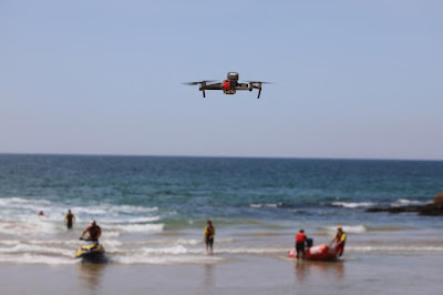
Surf Life Saving NSW has had a long association with aviation over its 112-year history – operating both fixed-wing aircraft and helicopters for search and rescue and marine creature surveillance. Now a new breed of ‘dry lifesaver’ is being trained to use unmanned aerial vehicle (drone) technology to help keep beachgoers safe on the NSW coastline.

SLSNSW February 18, 2020
In 2018 Surf Life Saving NSW became a gazetted emergency service organisation. Volunteers can be asked to respond to calls for assistance alongside police, ambulance and other emergency service organisations.

To enhance its capability, SLSNSW has established an extensive unmanned aerial vehicle (UAV) program to assist with beach safety, coastal surveillance, surf sports event management and search and rescue. UAVs, or drones as they’re more commonly known, have quickly become an integral part of surf life saving operations.

In December 2018, Surf Life Saving Australia partnered with Westpac to launch the Westpac Life Saver Rescue Drone Program. This saw 35 drones take to the skies across the NSW coastline as part of Australia’s first comprehensive approach to search and rescue using innovative drone technology.
The Westpac Lifesaver Rescue Drones are used by surf lifesavers and lifeguards to support rescue operations along Australia’s coastline and assist with critical response surveillance during emergencies.

In addition to search and rescue operations, SLSNSW has partnered with the Department of Primary Industries (DPI) for marine creature surveillance and operates 30 UAVs through this partnership. An additional 25 training UAVs will be added to the SLSNSW fleet during 2020.

UAVs are now used extensively in surf life saving patrols. The UAVs used are in the sub-2kg category and incorporate a high-definition camera and loudspeaker. Operating in almost 50 locations, SLSNSW currently has almost 70 drones working constantly along the NSW coastline.

“We initially introduced drones as a tool to complement all our other assets and resources. With the increase in technology, they’re becoming an essential part of our search and rescue operations,” said Paul Hardy, UAV Operations Coordinator and Chief Remote Pilot.

With over 70 drones in the air along the NSW coastline, keeping track of their exact location can be challenging. SLSNSW employs a number of flight tracking technologies including AVCRM (a cloud-based regulatory and compliance portal for all UAV operations) and AIRDATA (a cloud-based system to provide additional visibility to the UAV team on flight compliance and aircraft diagnostics) - which is used to track and log all flights.

Surf Life Saving operates in both the Commercial Excluded and Remote Operators Certificate (ReOC) categories and has advanced RePL trained pilots in many locations. It adheres to all the Civil Aviation Safety Authority (CASA) safety requirements.

drone, uav, uas, surf, ocean, rescue, search, lifesaving, lifeguard,
UAVs are becoming an essential tool in surf rescue
SLSNSW Seeks Dry Lifesavers

New UAV technology has enabled SLSNSW to create a new breed of “dry lifesaver” – volunteers who needn’t have any swimming ability to become a patrolling surf lifesaver. Pilots come from diverse backgrounds and include Qantas pilots right through to people with little or no aviation background whatsoever.

“We train pilots from diverse backgrounds. We encourage anyone who’s interested in becoming a UAV pilot to contact us, regardless of previous surf life saving or aviation experience,” said Paul Hardy from SLSNSW.

SLSNSW is actively recruiting and training pilots to boost its pool of 80 paid and 190 volunteer UAV pilots. SLSNSW runs its own pilot training programs along the NSW coastline.

Training consists of an internal training package delivered via a mix of theoretical and practical coaching and assessments. This is delivered to UAV pilots operating in the sub-2kg Commercial Excluded Category and exceeds CASA’s training requirements.

Beach Safety and UAV Awareness

Surf Life Saving NSW is focused on safety and procedures are in place to ensure that CASA rules and regulations are adhered to at all times.

Surf Life Saving NSW’s primary responsibility is to keep beaches safe for the public and its UAV operators actively educate private drone operators about the laws surrounding UAV use on and above beaches.

“Members of the public are increasingly aware that because SLSNSW is an emergency service organisation, they are unable to fly private drones at the beach when our UAVs are operating in the area,” said Paul Hardy, SLSNSW UAV Operations Coordinator.

“Beaches are an attractive place to fly drones and are used widely by the public to film activities like surfing and sailing and marine life like whales, dolphins and sharks. However, there are strict guidelines in place for the operation of UAVs near people and marine life.

“We encourage all private UAV pilots to familiarise themselves with rules for flying drones at the beach before they launch a drone,” he said.

With a presence at 129 of the most visited beaches across NSW, surf clubs are a frontline for communicating flight safety messaging to private drone pilots who may not be familiar with the regulations.

Surf Life Saving NSW continues to adopt new technology as it strives to achieve its goal of zero preventable deaths on the NSW coastline. Given its early success in surf life saving operations, it’s clear that UAV drone technology will continue to play an important part in coastal drownings prevention measures.

Tuesday, February 18, 2020

Police use drone to find blind man who had been missing for 33 hours

Police used a drone to locate a missing blind man in Connecticut who had become lost in a wooded area for over 30 hours.
A family member of the blind man contacted the Enfield Police Department on Feb. 15, saying they were concerned as they were unable to make contact with him, police said in a statement posted to Facebook. The police statement does not name the individual.
Officers determined that the man had not been seen since 10 a.m. the previous day. Based on their investigation and understanding of the missing man’s previous behavior, officers determined that it was likely that he had walked away from his home and become disoriented.  Continue Reading
Do you have a story of drones coming to the rescue or assisting your agency? Please share in the comments.

Monday, February 17, 2020

Training - Two Unmanned Aircraft System (UAS) Search and Rescue Courses Offered at ESCAPE 2020


Join Dave Crago as he teaches two exciting unmanned aircraft system (UAS) courses specifically geared towards search and rescue; UAS Field Support and Creating a UAS Program at ESCAPE 2020 at the beautiful Philmont Scout Ranch is the Boy Scouts of America's largest national High Adventure Base. 


ESCAPE or "Emergency Services Council Annual Preparedness Event" is the New Mexico Search and Rescue Council (NMSARC) annual statewide conference.  Volunteers from throughout the state meet to network and train on all aspects of effective search and rescue. 

Date;                     April 25-26, 2020

Location;              Philmont Scout Ranch – Cimarron, NM

Registration and more information is available at;  https://www.nmsarc.org/escape.html


Update March 9, 2020;
ESCAPE 2020 - CANCELLED
As SAR responders, we frequently go out of our way to make sure no harm comes to people.  After a fair amount of deliberation, unfortunately the majority of the board feels it is best to cancel ESCAPE for 2020 due to concerns about the spread of and possibility of spreading COVID-19. 

Monday, February 10, 2020

Training - Integrating UAS Into Ground Search and Rescue Operations

gis, gps, drone, uas, uav, public safety, emergency, response, sar, training, course, aerial,

Are you an unmanned aircraft systems (UAS) Pilot with a current FAA Part 107 Certificate looking to learn more about your UAS and how you and your aircraft can be safely and efficiently utilized on search and rescue (SAR) operations to help improve search and rescue results? 

Join EMMU Aerial and Cibola Search and Rescue on a training exercise where we will integrate UAS into ground search training.  Learn what the various members of the incident UAS team are responsible for from the remote pilot in command (RPIC) to visual observers (VO) and data specialists.
   
Training events have proved to be invaluable in order for the UAS Team and other SAR elements to be ready when a search mission suggests that the use of a UAS is both feasible and beneficial.

Date;                     March 7, 2020 0900

Location;              Embudo Trailhead in the foothills of the East mountains of Albuquerque,

Information;      Contact Dave Crago at cragod1@gmail.com

Sunday, February 9, 2020

Have drone will travel - Lakeview Hotshots Assisting With Prescribed Fires


Wildfire Today February 7, 2020

drone, uas, uav, fire, prescribed, wildfire, wildland,
Lakeview Hotshots are assisting with prescribed fires in the Southeast

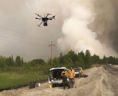
On February 6, 2020 the Lakeview Interagency Hotshots posted on Instagram saying that they are “ready for RX [prescribed fire] support in the Southeast.” Currently they have prescribed fire modules deployed in the southeast, usually with eight to 10 firefighters each.

The post included the hashtag #ignis2 which refers to the second-generation aerial ignition module Drone Amplified is manufacturing which enables drones to conduct aerial ignition on prescribed fires or wildfires. The crew included in their post the next two photos showing a drone aerial ignition system and a drone, both disassembled and packed into cases.

This year the Lakeview Hotshots have four qualified drone pilots. In 2018 their four pilots together completed over 100 missions.

Before the Lakeview IHC acquired Hotshot status in 2018 they were the Lakeview Crew 7 formed by the Bureau of Land Management. The crew was initially created in 2000 and reorganized in 2011 to help military veterans transition to productive civilian careers. Today it is comprised almost entirely of U.S. military veterans. The crew has been funded under the BLM Veterans Crew Program since 2012.