Thursday, December 27, 2018

Does your UAS Program Display a Level of Commitment


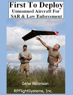
This was a great excerpt from the book “First To Deploy – Unmanned Aircraft for SAR and Law Enforcement” by Gene Robinson on level of commitment. 

Assembling a good UA team requires a commitment from several different levels. Management, team members, and peers, all must commit to the continued use and development of the UA as a tool to be integrated into operations where it is appropriate. If management views the UA as a novelty, only to be brought out during photo opportunities, then it will never see its full potential as a lifesaving piece of equipment. If the UA team is not given the support by management to continue training, develop and practice scenarios in the field, and actually use the UA on a frequent basis, then they will never be fully capable of acquiring or utilizing the valuable data the UA can provide. Frankly, this level of commitment requires funds to pay the salaries of those individuals who directly support and fly the UA. Maintenance and spare parts are required to ensure the UA is 100% operational, 100% of the time. For now, we have watched as unmanned aircraft have been relegated to part-time duty with poorly trained personnel and several flights ending in a debacle. When the time comes to really utilize the unmanned aircraft, the team is neither comfortable nor capable with the unit and the missions have a low completion rate.

drone, uas, uav, book, sar, search and rescue,

First to Deploy by Gene Robinson is a guide to the emerging technology of small unmanned aircraft systems (UAS), their capabilities, the sensors they can carry, and the data they can collect. This book is a chronicle of the development of a remotely piloted system and the migration to fully autonomous aircraft for Search & Rescue/Recovery operations in the United States. Unmanned aerial systems are reviewed from a standpoint of actual field use, not theory. Several missions are detailed by the author and demonstrate what has truly worked and the results that can be expected from a small unmanned platform.

Does your organization display a solid level of commitment?

Pick up a copy here; Purchase

Monday, December 3, 2018

Mapping Camp Fire Disaster with Drones

DJI November 2018
DJI works with 16 first response agencies for disaster response and damage assessment for California’s deadliest wild fire

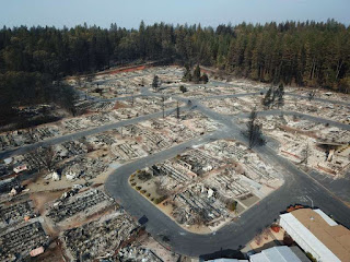
The towns of Paradise and Magalia in Northern California, nestled in the foothills of the Sierra Nevada, were once thriving communities with over 27,000 residents. On November 8th, 2018, the "Camp Fire" changed all of that within hours. Thousands have been affected by this wildfire, close to 100 people lost their lives, many thousands have lost their homes.

Aerial, Drone, Photo, Camp Fire, Disaster, GIS, UAS, UAV, GPS,

Over two days — hovering over the burned-out grounds of the state’s most destructive fire, a legion of drones began recording images of the devastation below in efforts to help the people who lost their homes. By the time they were done, they had collected 70,000 images over 17,000 acres resulting in 1.4 trillion pixels of data.

The detailed footage and maps would help people to determine the condition of their homes — and expedite insurance claims. The footage could also help recovery crews, demolition crews, city planners, scientists and researchers, and the general public, to get a better understanding of the situation. 

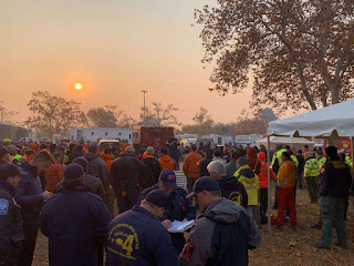
The 518 coordinated flights operation, by 16 Northern California emergency responder agencies, is one of the biggest drone response to a disaster scene in the nation’s history. The 16 UAV teams were led by Alameda County Sheriff's Office. Stockton Police, Contra Cost County Sheriff's Office & Menlo Park Fire Protection District had the most team members present, with Union City Police, Hayward Police and Stanislaus County Sheriff's Office providing units as well. San Francisco Police oversaw airspace mitigation. In addition to the mapping flights, over 160 full 360-degrees and interactive panoramas were created with the help of Hangar, as well as geo-referenced video was shot along major roads in Paradise through Survae. This layered data set was processed in record time. 

The photos and videos shot by drones were all georeferenced and stitched into a map format, making it possible for residents to check the status of their homes with the interactive AI app. Authorities in Butte County publicly released the maps and aerial photography even before many residents had been cleared to enter the fire zone to check their homes. Access Butte County's Camp Fire Map.

GIS, GPS, drone, uas, uav, wildland, fire wildfire,

We’re hoping that one, it will help people understand the devastation that we’re dealing with, understand the very difficult task that we have,” said Butte County Sheriff Kory Honea. “We’re hoping it’ll provide them information that will help them get their insurance claims started.”Read more

Thursday, November 29, 2018

DroneSAR & the Irish Coast Guard


Learn about how the Irish Coast Guard use drones to reduce risk and save lives

Do you have a story of drones coming to the rescue or assisting your agency? Please share in the comments.

Friday, November 9, 2018

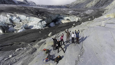
Expedition Greenland: Jimmy Chin Takes the DJI Mavic Zoom for a Spin

Drone Below November 5, 2018
The professional mountain photographer and filmmaker who is known for working at some of the most remote places on earth, Jimmy Chin, has been recently involved in a new film. This time, Chin collaborates with DJI to explore its flagship drone, the DJI Mavic Zoom, taking it to an expedition which follows the climber Alex Honnold as he became the first person to ever solo climb the 3,000ft El Capitan Wall at the Yosemite mountains.

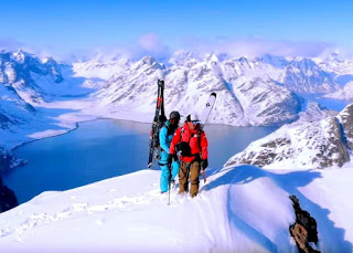
In his 20-year career, Chin is still inspired by the challenge of exploring new places and visiting mountains in remote places. For this Greenland trip where he films using the Mavic Zoom drone by DJI alongside a normal DSLR kit, Chin films the massive mountain grip through the 4K lens of the Mavic 2 Zoom, capturing full footage of the adventure.

jimmy chin, dji, mavic, drone, uas, uav,

The Mavic 2 Zoom: “Multi-Tool”
As he described the drone, it is a “multi-tool” that can be used for everything from high production value shots to scouting locations. For those who don’t know, the DJI Mavic 2 comes in two versions – the high-end ‘Pro’ version that has a 1-inch sensor and the less expensive and more flexible ‘Zoom’ drone which he used in Greenland.

From high-production value to “dolly zoom” scenes and tracking shots to scouting locations and routes, Chin noted that it might take hours to get up to a certain peak – but with the Mavic 2 Zoom the hours are made easier and more remote, allowing him (and the entire team) to go in search for great-looking sceneries and look out for hazards in a remote way.

Chin also points out to the fact that in such extreme conditions, gear needs to be reliable and easy to use. That is why the DJI Mavic 2 Zoom exceeds his expectations. In his own words, Chin stated:
“You need equipment that’s intuitive, and which you don’t have to spend a bunch of time figuring out how to make it work” because, as he says, “a lot of your mental bandwidth is taken up by making sure you’re being safe.”

As one can tell from seeing the videos, the aerial tracking sequences that show Deslaurier descending down the mountain slopes were among the favorite shots from the trip for Chin. Obviously, these are very difficult angles to get when you are high up in the remote areas – but for Chin – they were a challenge that he took and worked on with a great deal of passion and expertise.


“Incredible” – A Drone That Films While its Carried in the Top of (Your) Pack
Traditionally, these shots are also seen as high production value shots, and “being able to  create them with a drone that can be carried in the top of your pack is incredible,” according to Chin. Aside from praising the portability and flexibility of the DJI Mavic 2 Zoom, Chin also praises the quality of the video that it can capture.

“You need a camera which offers high quality, because shooting in a location like Greenland, you know it might not be possible to ever go back. Every shot is potentially a once-in-a-lifetime shot,” he confidently said.

Monday, November 5, 2018

Will These Rescue Drones Replace Lifeguards?


Larry Richardson November 3, 2018
Innovative life-saving drone tech could be coming to a beach near you. Delray Beach Ocean Rescue in Florida is the first lifeguard team in the United States to watch a demonstration of new drone technology designed to assist lifeguards in a rescue. In January 2018, the Westpac Little Ripper Lifesaver drone helped save two teenage boys caught in wild surf off Lennox Beach in Australia. Now, the company that makes the rescue drones is bringing the lifesaving technology to the US.

On Friday, November 2, 2018, Eddie Bennet, CEO of Australia-based The Ripper Group International, led his crew in piloting two drones in blustery conditions with moderate surf. The pilots located swimmers in less than a minute and dropped rescue pods that inflated on contact with the water. In an actual emergency, the drones would be used to locate the victims, drop rescue pods and monitor their condition until lifeguards could reach them.

Ripper Group engineers take off-the-shelf DJI drones and modify them. All feature cameras and the system that releases the rescue pods. The larger drone also has a powerful speaker and siren. The company also has a division that trains first-responders in their use.

Thank you to Delray Beach Ocean Rescue and The Ripper Group International for the opportunity to record this event. You can find out more about The Ripper Group International at littleripper.com.

Friday, October 26, 2018

Drone Search and Rescue Study Reveals Potential Limits

drone, uas, uav, search, rescue, sar,

A new study on the effectiveness of drones in finding lost individuals demonstrates drones can be an excellent tool, but a drone alone is no guarantee of a successful outcome.

The study on the effectiveness of drones in search-and-rescue (SAR) operations involved a series of simulated scenarios in Ireland and Wales, with drone-equipped teams searching for simulated victims alongside ground-only teams. They found that while drones could find victims about three minutes faster, the overall success rates were similar. The study, conducted by DJI, the European Emergency Number Association, and Black Channel, was presented at a recent conference and posted online.


Drone search-and-rescue study reveals potential, limits
Do you have a story of drones coming to the rescue or assisting your agency? Please share in the comments.

Thursday, August 30, 2018

EMMU Aerial’s Managing Director Dave Crago Flies Above the Crowd

gis, gps, drone, uas, uav, public safety, emergency, response, sar, training, course,

After more than 15 years in business and a major reorganization in 2006, Dave serves as EMMU Aerial’s Managing Director, providing leadership and direction for the company and the companies uunmanned aircraft systems (UAS), public safety programs, aerial photography, remote sensing, training, products and services.

Dave a lifelong Waterman and water rescue professional originally established EMMU or Emergency Mobile Mapping Unit after a merge with his other company Special Aquatic Service (SAS) in 1998 to meet an industry need for a specialized group qualified to responding to a public safety need for a true mobile emergency GIS response capability.  Drawing from years’ of water rescue, aviation, forestry, search and rescue and firefighting experience.  Dave was able to assemble a group of emergency response, GIS and aerial remote sensing professionals that was unsurpassed in the public safety industry.  EMMU went on to be a leader in the training and support of wildland firefighter, first responders and search and rescue professionals. 

Dave quickly learned that the opportunities for mobile GIS systems did not end with the limits of your imagination. While ideal for emergency management, the mobile GIS systems proved just as valuable for private, corporate and industrial research where onsite mapping technologies saved time and cut costs considerably.  It was also at this time, that EMMU established themselves as a leader in georeferenced oblique aerial photography, providing invaluable and accurate geographical information and imagery for various government agencies.

Today, Dave is an FAA licensed Part 107 UAS and federal government remote pilot and brings extensive knowledge of FAA and other federal, state and local drone regulations and protocols to the company.  Dave developed his skills through extensive operational aerial photography, remote sensing and UAS surveillance work with the military and government agencies. From these beginnings with government systems, EMMU Aerial now provides public safety agencies and organization with specialized UAS training, services and consulting for search and rescue, law enforcement, firefighting, disaster response and more throughout North America.  EMMU Aerial is at the forefront of a technological and operational change, focused on reinventing the way we work and look at the world.

Thursday, August 16, 2018

Wrightsville Beach Testing Drones In Water Rescues

 
Courtesy Of Wrightsville Beach Fire Department

The Wrightsville Beach Fire Department is experimenting with drones to help lifeguards with water rescues.

The department is testing equipment that allows drones to carry a lightweight inflatable buoy to swimmers who might be in distress, according to Wrightsville Beach firefighter Sam Proffitt. He said the drone can quickly fly a few hundred yards and drop the device.

"It will inflate once it hits the water. They can grab it and they can either hold it or clip it to them, and then we still have the other end of the rope on the beach. We take that, wrap it around the hitch on the back of a truck, and slowly pull that person into shore," Proffitt said.

The system is meant to assist lifeguards, not replace them, according to Proffitt. But drones could help law enforcement agencies in towns and cities where there are no lifeguards on duty.

"If someone gets in distress in a rip current, a lot of times it falls on a fire department to figure out how they're going to rescue that person," he said. "And you read a lot of stories where the rescuer then a lot of times becomes a victim because they're not trained to perform the rescue, so this could be a great option for them."

Even without the buoys, drones provide an extra set of eyes, Proffitt said. Local law enforcement agencies across the state have been experimenting with drones to help find victims of natural disasters, traffic accidents and other emergencies.

A Wrightsville Beach drone happened to be in the air Tuesday when the pilot spotted a swimmer in trouble and alerted rescuers. Watch them respond:

The swimmer was safely pulled from the water. Rescuers have saved hundreds of people along the coast this summer who were caught in suspected rip currents, but at least three have died.

Proffitt said the drone system is promising, but not perfect. There are tight restrictions on air space and drone regulations that prohibit pilots from flying them outside their line of sight.

Shared from; wunc.org 

Saturday, August 11, 2018

Will drones change the face of mountaineering and freeriding forever?


The unexpected hero on a recent rescue on the fearsome 8,000m K2 peak was a drone, which helped locate a missing climber. Will they change high alpine expeditions for ever?

Just before Andrzej Bargiel's made his historic ski descent of K2 recently, his brother Bartek Bargiel made headlines for another ground-breaking moment that could change the face of mountaineering forever – using a drone to locate a missing climbing legend on the fearsome mountain's slopes.

You might not want to call a 800g flying chunk of plastic, metal and circuitry an angel, but for Rick Allen, the Piolet d'Or winner who was briefly lost and presumed dead by his climbing partners, that DJI Mavic drone was exactly that.

The 65-year-old Scottish climber fell off a 30m cliff during a solo summit attempt on Broad Peak and most people in camp assumed he had died. His partner, Sandy Allan, wasn't ready to give up on him, though. Over at K2 camp, a cook from a Japanese climbing team used a telescope to scan the face of the mountain, spotting what he thought was a backpack. 

That's where Bartek Bargiel and his drone came in. He flew his drone in and from closer up, they realised the backpack was moving. Bargiel took pictures, video and, most importantly, marked the precise coordinates of the location using the drone's GPS system. This information he was then able to relay to rescuers in Broad Peak Base Camp. Bargiel then flew back-and-forth between Allen and the rescue team in the white glacier expanse until they found each other and Allen was in safe hands.

What else can drones do?
The rescue raises a question: what else can drones do? At this point, Bargiel's drone was able to help rescuers locate Allen, but not much more. However during his brother's summit bid, a member of their own team, experienced mountaineer Janusz GoÅ‚Ä…b, got stuck at a high camp with significant back pain, leaving him unable to descend on his own. In the past, the solution would have been to send someone up to help him get back down – a long and risky proposition. This time, Bargiel attached a small package to the drone and delivered GoÅ‚Ä…b the medical supplies he needed to then descend on his own.

Watch Andrzej Bargiel's epic descent from K2
Bigger drones can take bigger packages, though. Watch the video clip below of a drone helping rescue two swimmers caught in a riptide in Australia. The custom-built drone first helps locate them and then deploys a package that auto-inflates into a safety device. It certainly leaves no question that drones are already extremely valuable tools in wilderness search and rescue. 

Drones are the future, and the future is now

Brett Velicovich
American drone expert Brett Velicovich, a former military operator known as the 'Drone Warrior', believes the possibilities are nearly endless. "It's all about blade size, power and battery life," he says. "Those are the limitations. But there's a video of YouTuber Casey Neistat being lifted off the ground while snowboarding."

While that may be far off in reality, delivery of medical or rescue supplies is already a reality, as demonstrated above. Drones have been used to find missing people, deliver food after natural disasters or deliver a lifesaving device, but before they evolve in carrying capacity however, Velicovich believes they'll evolve in artificial intelligence.

"A UAV [unmanned aerial vehicle] is actually still manned, it's just the pilot is in a different place," he says. "Soon enough, drones will be able to identify and help someone in need without anyone piloting the drone. Drones are the future, and the future is now."

Helicopters are here to stay
Although he's got no problems with drones, ace alpinist and helicopter pilot Simone Moro offers up an opposing view that drones won't replace helicopters for a long, long time. "I've expected the current evolution. But we shouldn't use the word rescue, but rather support. Right now, all drones are using four or more rotors to stay balanced so a drone that could lift a person might actually be bigger and more expensive than a helicopter," he says.

That's without even touching the regulatory side. To do a real rescue, you have to follow aviation rules and regulation. "Everything becomes more complicated, forbidden, expensive and difficult," Moro says. "At the moment, drones are – and will remain for the next few years – an instrument to support a rescue, but won't replace a helicopter."

Then there's line scouting
Emergencies aren't the only reasons to have a drone in the air. For mountaineers, big mountain skiers and snowboarders they're an excellent tool to scout lines up close. In fact, world-class freeriders like Xavier De Le Rue consider quadcopters an indispensible tool, flying drones to gage the width of rock passages and the height of cliff jumps, the superficial impression of the snow cover and to identify rocks, trees or other significant landmarks. In the case of extremely dangerous routes, like Andrzej Bargiel's on K2, a drone was used to scout lines ahead of his exploit and in real time, helping Bargiel find a snowy line linking four known climbing routes to get safely down.  

Challenges exist for the moment. Drones (especially little ones like the DJI used on this recent alpine rescue) don’t do extremely well at high altitudes, where thin air makes it harder to fly them. Cold weather sucks the life out batteries very quick, too, limiting airtime and effectiveness. To demonstrate how rarely these now-popular devices are used here, Bartek Bargiel set a record for the highest known flight for a consumer-level drone during the K2 expedition. 

Eyes in the sky: cool or creepy?
The wilderness – and especially the high alpine – is a different environment. The people who going to those places have never been ashamed to say the escape from modernity and technology is part of the appeal, even as technology becomes an increasingly normal part of the mountain experience.
The high-pitched whirr of a miniature flying machine with a camera couldn't be a more perfect symbol of what many mountaineers are trying to get away from. Allen felt that way himself. "I had a big aversion to recreational drones in beautiful places, intruding on my experience," he says. 

"However, I now see huge potential in mountain rescue scenarios, as they can be so easily transported and deployed for a local search if the visibility is reasonable. I was glad to see this one!

"The drone was a great encouragement, as I figured it was not there by accident, which meant someone on the glacier knew I was alive and would tell my team. I wasn't looking for a helicopter rescue, I was pretty confident I would get to Camp 3 eventually, but I just wanted them to know I was alive and moving."

The drone was a great encouragement

Rick Allen
In conclusion, drones are pretty great for rescue
Rick Allen is pretty much convinced. "I see drones as a very valuable tool for scouting new routes on big mountains. It could reduce some of the uncertainties," he says. Will it be a crutch for less experienced climbers, leading to more problems on the mountain? "I wouldn't say that, because it would still leave unknowns, like the snow condition," continues Allen. "There are plenty of more insidious crutches that can get folk into trouble. Better information is usually a good thing."

There is one thing his guardian angel drone failed at however – letting his team-mates know he had a plan to get out on his own. "I was pretty confident I would get to Camp 3 eventually," says Allen. 

"My plan was always to climb up and rightwards in order to be able to descend to Camp 3. I told the drone, but, of course, it had no microphone!" We'll have to wait a little longer for the tech to catch up. 

Wednesday, June 20, 2018

Drone finds 75-year-old man who got stuck in marshes


A 75-year-old man who got lost while out walking with friends was found by a drone 20 hours after he was reported missing. Peter Pugh had been walking with friends and family on Brancaster Beach at approximately 5pm on June 16 when he became separated from the group. Footage from the drone shows how Mr Pugh was found at approximately 2:30pm the following day after becoming stuck in the marshes.

Do you have a story of drones coming to the rescue or assisting your agency? Please share in the comments.

Thursday, June 14, 2018

Rescue drones begin operations in Baltic Sea


For the first time, drones equipped with Restube-buoys will be used on the Baltic Sea coast in Germany to give help to swimmers in distress

For the first time, drones equipped with Restube-buoys will be used on the Baltic Sea coast in Germany to give help to swimmers in distress. Start-Up company RESTUBE GMBH equipped the lifeguards of the German Red Cross division with its safety device for drones for all 14 beaches at the Baltic Sea.

Water Rescue in Mecklenburg-Western Pomerania started officially at the beginning of the 2018 swimming season. Restubes do not replace lifeguards but the time until the person in water receives flotation assistance can be reduced radically with its deployment. Once the Restube-buoy is dropped, it inflates automatically with water contact so that the rescued person can hold on until a lifeguard arrives.

The lifeguards of the German Red Cross Division operate 18 Restube equipped drones at 14 beach sections at the Baltic Sea as well as on four inland lakes.

Friday, June 1, 2018

Training - Part 107 Drone Pilot Test Prep Course

gis, gps, drone, uas, uav, public safety, emergency, response, sar, training, course, faa, 107,

Pass the Part 107 FAA Drone Pilot Exam The First Time!

Course Description:

EMMU Aerial is offering the popular Part 107 Drone Pilot Test Prep Course

To fly your drone under the FAA's Small UAS Rule (Part 107) for commercial purposes, you must obtain a Remote Pilot Certificate from the FAA.  This certificate demonstrates that you understand the regulations, operating requirements, and procedures for safely flying drones. 

In order to get the Part 107 Remote Pilot Certificate, you need to pass the FAA drone pilot test called the Airman Knowledge Test. The two-hour, 60 question test requires extensive studying and our course teaches you everything you need to know.  Knowledge test topic areas include:

  • Applicable regulations relating to small unmanned aircraft system rating privileges, limitations, and flight operation
  • Airspace classification and operating requirements, and flight restrictions affecting small unmanned aircraft operation
  • Aviation weather sources and effects of weather on small unmanned aircraft performance
  • Small unmanned aircraft loading and performance
  • Emergency procedures
  • Crew resource management
  • Radio communication procedures
  • Determining the performance of small unmanned aircraft
  • Physiological effects of drugs and alcohol
  • Aeronautical decision-making and judgment
  • Airport operations
  • Maintenance and preflight inspection procedures
Taking and completing the in-person class is the right decision. Having an EMMU Aerial instructor to answer your questions as you learn through the material will be a key to success when you take your exam.

  • 16 Hours of In-Person Training
  • Learn from one of our expert instructors
  • Part 107 Student Guide
  • Practice Test Questions
  • Money Back Guarantee*
*For any students who take our Part 107 Test Prep course and achieve a 90% or better on at least 3 practice exams, we will pay for you to take the exam again if you do not pass.

Course Prerequisites - None

Date;                    August 25, 2018

Length;                16 hours

Cost:                      $400.00   
             
Location;             Melbourne, Florida

Contact EMMU Aerial for more information and to enroll

Thursday, May 31, 2018

Drone Used to Help Rescue 4 Stranded in Brazos

WHITNEY, Texas (KWTX) Four people stranded in the middle of the Brazos River below the Lake Whitney dam were rescued Thursday.

A drone, flown by Hill County Emergency Management Coordinator Tom Hemrick, delivered a lifejacket to a mother and her 15-year-old daughter to keep them afloat before a rescue boat arrived.

Authorities say they didn’t know how to swim and got stranded as the water levels were rising.

“The stranded individuals had no swimming skills nor devices to keep them afloat with the water rising,” said Chief Deputy Rick White.

“That lifejacket served as a real lifesaving device until water vehicles could arrive to extract them from the river.”

As rescuers were getting the mother and daughter into the air boat provided by the West Shore Department, two men in kayaks were found stranded several hundred yards farther down the river.

“There’s warning signs, please take heed of the warning, especially in that lower part of the dam,” said White.

“Do not try to cross the river form one county side to the other, don’t get out in the middle and float in inner tubes or stand out there, because when those alarms sound generally there is not enough time to return to shore.”

The events forced the Army Corps of Engineers to shut down the dam’s water release.

Hillsboro Fire, DPS, West Shore VFD, Whitney Police Fire and Rescue, the Lake Whitney Corps of Engineers, Lake Whitney Park Rangers, HCSO and Hill County Emergency Management responded.

“We’re lucky we got everybody out,” said White.

Tuesday, May 29, 2018

Colorado search and rescue teams are using drones to find lost adventurers


To more efficiently manage already limited resources, volunteer search and rescue teams across the state are now using drones as their eyes in the sky.

Friday, April 20, 2018

Police use of drones expands rapidly in North Carolina


A small unmanned aircraft system, or drone, being operated by the Fayetteville Police Department. Courtesy of the city of Fayetteville

On a cold Christmas Eve night, the man found himself stuck up to his waist in the mud of a swampy area surrounded by deep and frigid creeks in Cumberland County, when a small flying object passed over his head.

The object was a Fayetteville Police drone. It may have saved his life.

The man “had outstanding warrants and ran from a traffic stop … to elude officers,” Fayetteville Police Chief Gina V. Hawkins told Carolina Public Press.

“The subject crossed at least two sections of creek that were over his head. The temperature that night was 40 degrees and the suspect became lodged in the mire. The incident quickly became a rescue mission with the use of the drone to safely guide the officers to the suspect’s location.”

Fayetteville police publicly unveiled their year-old drone program on April 10, touting its early successes, including the Dec. 2017 rescue as one of their small unmanned aircraft systems (sUAS) program’s successes.

“Due to the frigid temperatures at the time and … that the suspect was stuck in silt, it is highly probable the suspect would have succumbed to hypothermia without the aid of the aviation unit,” a Fayetteville Police Department statement said.

A growing number of law enforcement agencies in North Carolina have initiated drone programs since 2016, when recent changes in both costs and regulations made the unmanned systems practical for local agencies.

The promise of drones, like any tool, comes with concerns about their potential abuse. Observers wonder about erosion of protections against unlawful searches. Courts and lawmakers haven’t yet set precedents or passed legislation to address all of the potential questions raised by the rapidly developing technology.

Law enforcement agencies are keenly aware of these concerns. But as CPP talked with agencies across the state, their answers to drone use varied widely.

While Fayetteville emphasized the potential for drones in rescue situations and said the department will not use them for “vehicle pursuits, to assist in issuing traffic citations (or) for routine patrols,” the December incident was also described as an effort to located a wanted suspect.

This article takes a look at the rapid adoption of drones by the law enforcement and the legal and practical implications.

Read More; Carolina Public Press


Friday, February 2, 2018

New Search and Rescue Drone - Texas Parks and Wildlife Department


Texas game wardens are adding a new set of eyes in the sky with a new Search and Rescue Drone or Unmanned Aircraft System (UAS). Watch this simulated rescue of some lost children.

Friday, January 26, 2018

Training - Small Unmanned Aircraft System (sUAS) Basic Remote Pilot Course for Public Safety

gis, gps, drone, uas, uav, public safety, emergency, response, sar, training, course,

Course Description:

Once again, EMMU Aerial is offering the popular (sUAS) Basic Remote Pilot Course.  This is the fundamental sUAS course for individuals wanting to become qualified to operate sUAS for a Public Safety Agency.  The sUAS course will utilize small sUAS aircraft to provide the basic academic and flight training necessary to conduct missions as Remote Pilot-in-Command (RPIC).

UAS can positively impact every element of your agencies by utilizing state of the art equipment.  UAS derived data and imagery empowers firefighter, law enforcement, incident personnel, and senior leaders to make informed decisions based on precise and real-time information.  Data gathered from UAS is unique due to the ability of the aircraft to fly low, slow, and for long periods of time while collecting high-resolution imagery.

The Basic Remote Pilot Course is designed to qualify students to safely operate a sUAS in the field environment and capture video/stills of a point of interest with multirotor aircraft and applicable sensors.

Course Prerequisites

Must obtain FAA Part 107 Remote Pilot Certificate at least two weeks prior to class. Students should expect to show a physical copy of their certificate to an Instructor.

Date;                     April 16, 2018
Length;                 32 hours
Location;              Volusia County, Florida

Contact EMMU Aerial for more information and to enroll

Friday, January 19, 2018

Drone Rescues Swimmers Caught in Rough Surf in Australia in World First

January 18, 2018
Caught in rough surf far from shore, stranded swimmers might hope for a lifeguard to appear amid the waves.


But for two men recently rescued off the coast of Australia's Lennox Head, New South Wales (NSW), a different kind of savior showed up: a drone.

In what's being hailed as a first-of-its-kind rescue, the new lifesaving device -- the Little Ripper UAV -- flew into action after someone spotted the swimmers in distress in a nearly 10-foot (3-meter) swell more than a half mile (about 1 kilometer) off a patrolled area, Surf Life Saving NSW said in a news release.

Within minutes, lifeguards piloted the drone to the men and dropped an inflatable life preserver.
The two clung to the rescue pod and made it to shore, where lifeguards were waiting, Surf Life Saving NSW said. They were exhausted but unharmed. And the drone had recorded the whole rescue.

"The Little Ripper UAV certainly proved itself today. It is an amazingly efficient piece of lifesaving equipment and a delight to fly," said Lifeguard Supervisor Jai Sheridan, who piloted the drone during the rescue.

"I was able to launch it, fly it to the location, and drop the pod all in about 1 to 2 minutes," he said. "On a normal day, that would have taken our lifeguards a few minutes longer to reach."

The rescue, which happened as lifeguards from the Australian Lifeguard Service were preparing for a training session with the brand-new drone fleet, was lauded as groundbreaking.

"Never before has a drone fitted with a flotation device been used to rescue swimmers like this," Deputy State Premier John Barilaro told the BBC.

The NSW government invested $430,000 in funding to Surf Life Saving NSW for the drone project, the organization said.