Wednesday, December 20, 2017

Training - Part 107 Drone Pilot Test Prep Course

gis, gps, drone, uas, uav, public safety, emergency, response, sar, training, course, faa, 107,

Pass the Part 107 FAA Drone Pilot Exam The First Time!

Course Description:

EMMU Aerial is offering the popular Part 107 Drone Pilot Test Prep Course

To fly your drone under the FAA's Small UAS Rule (Part 107) for commercial purposes, you must obtain a Remote Pilot Certificate from the FAA.  This certificate demonstrates that you understand the regulations, operating requirements, and procedures for safely flying drones. 

In order to get the Part 107 Remote Pilot Certificate, you need to pass the FAA drone pilot test called the Airman Knowledge Test. The two-hour, 60 question test requires extensive studying and our course teaches you everything you need to know.  Knowledge test topic areas include:

  • Applicable regulations relating to small unmanned aircraft system rating privileges, limitations, and flight operation
  • Airspace classification and operating requirements, and flight restrictions affecting small unmanned aircraft operation
  • Aviation weather sources and effects of weather on small unmanned aircraft performance
  • Small unmanned aircraft loading and performance
  • Emergency procedures
  • Crew resource management
  • Radio communication procedures
  • Determining the performance of small unmanned aircraft
  • Physiological effects of drugs and alcohol
  • Aeronautical decision-making and judgment
  • Airport operations
  • Maintenance and preflight inspection procedures
Taking and completing the in-person class is the right decision. Having an EMMU Aerial instructor to answer your questions as you learn through the material will be a key to success when you take your exam.

  • 16 Hours of In-Person Training
  • Learn from one of our expert instructors
  • Part 107 Student Guide
  • Practice Test Questions
  • Money Back Guarantee*
*For any students who take our Part 107 Test Prep course and achieve a 90% or better on at least 3 practice exams, we will pay for you to take the exam again if you do not pass.

Course Prerequisites - None

Date;                    March 24, 2018

Length;                16 hours

Cost:                      $400.00   
             
Location;             Melbourne, Florida

Contact EMMU Aerial for more information and to enroll

Monday, December 18, 2017

L.A. Fire Department used drones for the first time during Skirball fire

The Los Angeles Fire Department dispatched drones for the first time while battling a wildfire this month as firefighters took on the Skirball fire in Bel-Air.
Fire officials demonstrated the use of the unmanned aerial vehicles for reporters on Thursday, sending two drones buzzing near blackened hills around Linda Flora Drive.
“They provide real-time situational awareness from a bird’s-eye perspective to the incident commander so they can see what’s going on at their emergency and then change their tactics accordingly to mitigate the hazards,” said Capt. Erik Scott, an LAFD spokesman. Read More

Monday, November 20, 2017

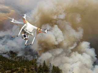
Drones are fighting wildfires in some very surprising ways

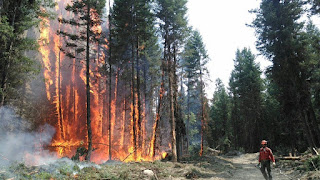
Bad as they are, the wildfires now raging in southern California aren't exactly unprecedented. Wildfires in the U.S. were brutal last summer too, scorching more than 8.8 million acres and cloaking the Pacific Northwest in smoke and ash. In California alone last year, more than 40 people died and 8,400 buildings were destroyed in the deadliest wildfires in the state’s history.
Things may only get worse in years to come. Climate change is lengthening fire seasons and triggering more and larger blazes.
But aerial drones may help save the day. In fact, the Los Angeles Fire Department today said it would use firefighting drones for the first time in its history to coordinate the effort to help extinguish a pair of fires threatening homes in the city.  Read More
drone, fire, uas, uav, wildfire,

Wednesday, October 18, 2017

Case Study: Wildfire Hot Spot Mapping with a Thermal Imaging Drone

Using Drones to Combat Wildfires

The Canadian province of British Columbia has experienced the worst wildfire season in recorded history. Over 2 million acres have been burned, and at its peak, 45,000 people were displaced.1 The British Columbia Wildfire Service (BC Fire) deployed every available resource, including four types of fire crews, 24 fixed-wing aircraft, 6 helicopters, and out-of-province resources.2 This year, BC Fire tested a new tool: drones.
Drones equipped with thermal infrared cameras can see hot spots in the forest that are primed for ignition, as well as areas that may have escaped containment. In some cases, roots may smolder for several days beneath the ground surface. If hot spot locations are provided to the fire crew in a timely fashion, they can cool or extinguish them to prevent further spreading. It is also critical to “clear” the area before civilians are allowed to return into an evacuation zone. Drones excel at mapping and data collection, which frees up larger wildfire aviation assets to deploy crews, move equipment, and drop flame retardants and water onto the wildfire. Read More

drone, uas, uav, wildfire, wildland, fire,

Friday, September 1, 2017

San Francisco Bay Area Water Rescue Team Uses Drones in continued Search and Rescue Operations around Houston, Texas.

While I couldn't deploy with the California Task Force 3 Water Rescue Team to Houston over the weekend, I have been tracking their deployment, as well as other official UAV teams in the area.

It is clear to me that Hurricane Harvey will provide a tremendous amount of "Lessons Learned" when it comes to the use of UAVs, the implementation and the regulatory environment during and after a large scale disaster. I predict that Public Safety will use UAVs in many more ways in the very near future - because this is all such new technology, the focus has mostly been on utilizing drones during an incident. It's evident that pre-disaster use, and as we already know, post incident data gathering are also extremely beneficial. The mapping of levees, river beds, structures before an incident can provide very helpful data for modeling purposes, for evacuation and search and rescue operations. Comparing pre and post disaster data of the same area allows researchers, scientists, engineers and city planners to improve upon city layouts and infrastructures.

Below is an account from Menlo Park Fire Protection District, which has several members in the Houston area, utilizing their drones for a variety of tasks. I wanted to share this as these are the stories that highlight the tremendous benefits of this technology and shows how our first responders are implementing new technologies to not only help save other people's lives and properties, but to also keep themselves more safe and efficient. If you have any questions, do not hesitate to contact me or Menlo Park Fire Department, Harold Schapelhouman (Fire Chief).  Read More

Friday, August 4, 2017

Training - Part 107 Drone Pilot Test Prep Course

gis, gps, drone, uas, uav, public safety, emergency, response, sar, training, course,

Pass the Part 107 FAA Drone Pilot Exam The First Time!

Course Description:

EMMU Aerial is offering the popular Part 107 Drone Pilot Test Prep Course

To fly your drone under the FAA's Small UAS Rule (Part 107) for commercial purposes, you must obtain a Remote Pilot Certificate from the FAA.  This certificate demonstrates that you understand the regulations, operating requirements, and procedures for safely flying drones. 

In order to get the Part 107 Remote Pilot Certificate, you need to pass the FAA drone pilot test called the Airman Knowledge Test. The two-hour, 60 question test requires extensive studying and our course teaches you everything you need to know.  Knowledge test topic areas include:

  • Applicable regulations relating to small unmanned aircraft system rating privileges, limitations, and flight operation
  • Airspace classification and operating requirements, and flight restrictions affecting small unmanned aircraft operation
  • Aviation weather sources and effects of weather on small unmanned aircraft performance
  • Small unmanned aircraft loading and performance
  • Emergency procedures
  • Crew resource management
  • Radio communication procedures
  • Determining the performance of small unmanned aircraft
  • Physiological effects of drugs and alcohol
  • Aeronautical decision-making and judgment
  • Airport operations
  • Maintenance and preflight inspection procedures
Taking and completing the in-person class is the right decision. Having an EMMU Aerial instructor to answer your questions as you learn through the material will be a key to success when you take your exam.

  • 16 Hours of In-Person Training
  • Learn from one of our expert instructors
  • Part 107 Student Guide
  • Practice Test Questions
  • Money Back Guarantee*
*For any students who take our Part 107 Test Prep course and achieve a 90% or better on at least 3 practice exams, we will pay for you to take the exam again if you do not pass.

Course Prerequisites - None

Date;                    October 21, 2017

Length;                16 hours

Cost:                      $400.00   
             
Location;             Melbourne, Florida

Contact EMMU Aerial for more information and to enroll

Friday, July 28, 2017

Training - Small Unmanned Aircraft System (sUAS) Basic Remote Pilot Course for Public Safety

gis, gps, drone, uas, uav, public safety, emergency, response, sar, training, course,

Course Description:
Once again, EMMU Aerial is offering the popular (sUAS) Basic Remote Pilot Course.  This is the fundamental sUAS course for individuals wanting to become qualified to operate sUAS for a Public Safety Agency.  The sUAS course will utilize small sUAS aircraft to provide the basic academic and flight training necessary to conduct missions as Remote Pilot-in-Command (RPIC).

UAS can positively impact every element of your agencies by utilizing state of the art equipment. UAS derived data and imagery empowers firefighter, law enforcement, incident personnel, and senior leaders to make informed decisions based on precise and real-time information.  Data gathered from UAS is unique due to the ability of the aircraft to fly low, slow, and for long periods of time while collecting high-resolution imagery.

The Basic Remote Pilot Course is designed to qualify students to safely operate a sUAS in the field environment and capture video/stills of a point of interest with multirotor aircraft and applicable sensors.

Course Prerequisites

Must obtain FAA Part 107 Remote Pilot Certificate at least two weeks prior to class. Students should expect to show a physical copy of their certificates to an Instructor.

Date;                     October 9, 2017
Length;                 32 hours
Location;              Brevard County, Florida

Contact EMMU Aerial for more information and to enroll