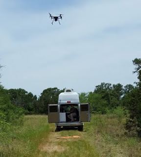
Loc8 is pleased to
announce that it will be collaborating with Texas State University and the
University of Missouri on a $280,000 grant to utilize drones to locate human
remains and detect clandestine graves. This grant, which was awarded by the National Institute of Justice (NIJ), continues the groundbreaking
research conducted in 2015 by Gene Robinson, president of GRC Consulting, and
the Texas State Anthropology Department.
Pilot for the NIJ project Gene Robinson stated, “The
ability of Loc8 to scan down to the individual pixel level in each image is
going to change the way remote sensing is used in search and rescue (SAR)
missions and crime scene investigations. The Loc8 software has only been
available since 2019 and we have already realized successes in the field. We
are just now scratching the surface in the different ways Loc8’s image analysis
algorithms can be used.” The NIJ project is slated to handle a wide array of
remote sensors from standard RGB, to near infrared (NIR), to thermal (FLIR) and
multi-spectral imagery to detect subtle changes in the environment resulting
from human remains on or under the ground from the vantage point of a deployed
drone.
The NIJ Grant project data collection flights began in
late January 2020. Over the next two-years, the flights are scheduled to
continue on a near daily or weekly basis depending upon the stage of the study.
The research is being conducted in the Texas State University’s 26-acre
open-air forensic laboratory. Under the NIJ project, eight to ten science
pledged body donation volunteers (cadavers) will be studied under various
scenarios designed to mimic ground conditions of undiscovered clandestine
sites. The University of Missouri is tasked with the image/data analytics and
will act as the repository for all the data collected.
Robinson added, “The Texas State Forensic Anthropology
Research Facility replicates conditions and environments of some of the tough
cases we have encountered in the past 15 years. We can really bring the current
technology to bear in a scientific way that will be a tremendous benefit to
both law enforcement and the search and rescue community.”
The research has already begun at the Texas Hill Country
facility and will simulate different environments and seasonal effects on the
forensic investigative process. The project will identify best practices for drone
utilization, determine the most effective sensors, and explore the advantages
of using an image analysis software like Loc8 to enhance the effectiveness and
thoroughness of the search and rescue or recovery investigative process.
As part of the NIJ Project, Gene Robinson will be
cataloging the changes in the color palettes of the volunteer subject’s skin,
soft tissue, and skeletal remains during the natural decomposition process. These
color palettes will then made available as sample data sets for Loc8
subscribers to use during their search and rescue/recovery missions. The Human
Remains color palette dataset is one of many datasets Loc8 is
developing to assist subscribers.
Loc8 (www.loc8.life) is a patent-pending
image scanning technology that analyzes the individual pixels in a digital
image (still or video) by searching for colors that match a userdefined color
palette. Once the defined pixel color(s) are detected in the scanned images, Loc8
reports the latitude, longitude, and the altitude of the geographical location
of the detected item(s).
Loc8 was originally developed to scan
digital images (still or video) quickly and thoroughly collected during search
and rescue/recovery (SAR) missions. However, since its release, the Loc8
algorithm has been tested as a tool in crime scene investigation, accident reconstruction,
debris field mapping, precision agricultural management, wildlife population
management, and utility infrastructure inspections, to name a few of the many potential
applications.


