Tuesday, March 31, 2020

Public Safety Agencies Require UAS Training That Is Up to The Job

Unmanned Aircraft Systems (UAS) are frequently being called into public safety service to search for missing persons and victims of natural disasters, inspect crash sites and chemical spills, map wildland fires and flooding, surveil public events for security threats and assess scenes at a safe distance when conditions are too dangerous.

With such diverse and practical applications for public safety, it’s no wonder that some public safety agencies are eager to implement UAS programs. In order to get the program up and running quickly, some public safety agencies are opting to buy commercial-off-the-shelf UAS to do important tasks they are often not suited for.  More importantly, agencies often overlook the most important component in a UAS, a well-trained pilot.

drone, uas, uav, incident, course, training, wildfire, public safety,
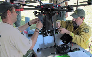
Photo from National Wildfire Coordinating Group

Chief Charles Werner (ret.), Director of DRONERESPONDERS says"without formalized standards, the UAS training and certification landscape is like a “patchwork quilt of home-grown training solutions, which threatens the ability of public safety agencies to build consistent operating practices between jurisdictions." 

Members of public safety agencies are required to undertake continuing education and prove their qualification to carry a firearm, work with hazardous materials, emergency response and even basic CPR.  UAS pilot training should be of a similar professional quality well beyond FAA’s Part 107.

With the advent of UAS, thousands of companies have entered the marketplace hoping to sell their devices and/or services to Public Safety agencies. Over 1,000 agencies around the country are openly using UAS, with numerous others doing so discreetly. But who fosters the proper integration of UAS into these agencies?

In some cases, that falls to commercial companies without any Public Safety background. Others end up having to utilize hobbyists turned entrepreneurs. Part 107 certification has lowered the barrier to entry for the technology and created tremendous opportunities, but receiving certification requires little more than passing a multiple choice only exam that's designed for a 16-year-old high school student. It falls well short of the standardized proficiency which the public expects from the men and women who we depend on.

After all, learning to fly figure 8's or an obstacle course around a park may teach you good maneuvering skills, but it doesn’t teach you how to locate a lost family, acquire the acreage of a wildfire, mark hotspots or make entry into a building in support of law enforcement.

No first responder wants to unintentionally interfere with rescue or tactical operations or find out in the midst of a crisis that his or her UAS training has not prepared them for the situation at hand.  To insure this never happens, when acquiring training for your agency, look for a company that has practical training and experience in public safety and UAS for the unique applications that your agency requires. 

Several Federal agencies now have internal courses, like the Department of Interior with the A-450 Basic Remote Pilot Course and the National Wildfire Coordinating Group (NWCG) with the S-373 UAS Incident Operations Course, both are excellent courses.  But even after completing training, individuals must continue gaining experience and knowledge through completion of their NWCG task books in training and actual incidents. 

This certifies that UAS pilots in the agency are not only qualified to operate the UAS as trained, but possess the technical competency and knowledge to understand the UAS and use it in specialized ways when lives and property are at risk.

When researching training for your agency, find a company that offers the specific UAS public safety training to meet your agencies mission requirements. 

But most importantly ensure the company and the instructors have solid training and experience in public safety and integrating UAS into operations.  A company that’s instructors work in public safety and actually found a lost family, acquired the acreage of a wildfire, marked hotspots or made entry into a building in support of law enforcement.   

Content for this post from; PoliceOne.com Laura Neitzel for PoliceOne BrandFocus and Icarus Aerospace

Sunday, March 29, 2020

Drones to the Rescue! How the Public Benefit of Drones Far Outweighs the Risks

Commercial UAV News March 17, 2020
While the positive public perception of drones has increased over the last five years, real and perceived fears about drones persist, often restricting progress for good. In the UK (which has dealt with prison drone deliveries by gangs, a number of near misses, and the December, 2018 Gatwick drone incident which led to flight cancellations and the stranding of thousands of passengers), there is a definite mistrust of drones evidenced by the April 2019 PwC research study finding less than a third of those polled in the UK feeling positive about drone technology. The same is true in the United States where a December 2019 Hawthorn Group research study found 68% “concerned” about the safety of drones, with only 7% “not concerned at all.” While 51% supported drone delivery, 49% thought it was “too dangerous” with 71% having privacy concerns.

drone, uas, uav, rescue, search, sar, public safety,

While the public benefit of drones is well documented even before the newly permitted commercial use of drones by the FAA, there is still an uphill battle to win the public over on the truth that despite the risks that come with drones, there is a huge upside. It is becoming clearer day by day that drones not only have the potential for simplifying our lives, but also in making our world safer. The use of drones by police to track criminals, by firefighters to get a better perspective on fires, and by municipalities to do safety reviews of water tanks, oil pipelines and electrical lines is evidence of the public safety impact drones can have – and we are only in the infant stages of the public use of this emerging technology.

The recent outbreak of the novel corona virus (COVID-19), requiring people to be quarantined to attempt to slow down this worldwide pandemic, opens up another potentially huge public benefit of drones. While commercial drone delivery is just beginning in the United States, imagine the potential public health benefits of drones delivering medical supplies and food to quarantined individuals, hospitals or government run facilities. Drones could potentially answer the question of how quarantined individuals could sustain themselves over an extended quarantine, thereby also hopefully reducing the hoarding we have seen across the U.S.

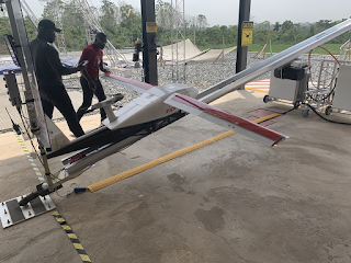
I experienced the vast potential for drones recently when I was privileged to visit a Zipline Center just north of Suhum, Ghana. Zipline is a for profit corporation established in the San Francisco area in 2014 which is already having a huge impact on public health in Africa. Their 2 meter long Styrofoam unmanned aircraft with a wingspan of 3.3 meters are saving lives in Rwanda and Ghana through contracts with those countries’ health organizations to deliver blood, vaccines and other medical supplies to remote areas difficult to access by road.

I was first exposed to Zipline at the AUVSI (“Association for Unmanned Vehicles Systems International”) Conference in Denver in May 2018 where the company was one of the recipients of the Inaugural AUVSI XCELLENCE Humanitarian Award for their work in medical supply delivery in Rwanda. As I am currently based in Accra, Ghana working as the Director for West Africa on a project for Pepperdine School of Law’s Global Justice Institute, I became aware of Zipline’s award of a four-year $12,000,000 contract with Ghana’s National Health Service in December of 2018. As Zipline’s first “center” in Ghana is located in Omenako, Ghana which is about an hour and a half drive north of Accra just past Suhum, I obtained permission from Daniel Marfo, the General Manager of Zipline International, to have a tour and interview some of its staff.

Omenako is one of four Zipline Centers in Ghana and covers the entire Eastern Region. It began operation on April 19, 2019, with the Mampong Center opening on October 19, 2019 and covering the majority of the Ashanti Region as well as Brong-Ahofo Region. These two facilities are currently servicing over 200 medical facilities with each doing approximately 35 deliveries per day, 7 days a week. The Wale Wale Center serving the Northern Region is set to open in March, 2020, with the Sefwi Wiawso Center serving the Western Region set to open in April. The goal is for each center to service 500 Health Facilities each within the next 4 years.

All manufacturing of this Styrofoam unmanned winged aircraft is done at Zipline’s manufacturing facility in Davis, California, including its lithium-ion battery which doubles as a black box downloading data from the previous flight while being recharged. Zipline’s “Robin” drone has an 80 km range while the newer “Sparrow” has a range of 120 km flying at 400-500 meters at 100 km/hr. Medical supplies are placed in a composite compartment with a capacity of up to 1.75 kg or almost 4 lbs. If blood or other temperature sensitive supplies are being delivered, ice packs are placed around the product which is then placed in a bubble lined cardboard box with a paper parachute, both of which are weather resistant.

I was able to witness a delivery firsthand when I visited the Omenako Center on February 27th. Once a health facility in Ghana requests service to begin, and Zipline is able to visit and establish coordinates for a drop zone, they get a flight plan approved by the Ghana Civil Aviation Authority and then once approved, they are ready to fly to that facility. The delivery I witnessed was medical supplies going to the Pakro Health Center which by road would take at least an hour and a half not taking into account bad traffic or an accident. If it was the rainy season, the road to Pakro could easily be flooded out making delivery difficult if not impossible. Other health facilities are across Lake Volta which means far longer transport by road as they need to cross by ferry. A Zipline drone can deliver a package to Pakro in 25 minutes, rain or shine, night or day. Imagine what that time savings could mean to a patient who needs a blood transfusion for example – literally a matter of life and death.

Once the delivery was called out on the loudspeaker, the medical supplies already packed were brought to the window of the temperature and environmentally controlled supply center and then given to the flight personnel – in this case it was John Baptist, the Flight Lead at Omenako. Once John packed the box into the frame of a Robin drone, it was brought to the catapult style launching pad that is unique to Zipline. Once placed on the track, the wing is put in place, the battery is connected, and they are ready to go within 5 minutes. Almost immediately after the aircraft was put together, its double propellers began whirring and the aircraft literally “zipped” away with vital medical supplies for Pakro.

I was then excited to hear over the loudspeaker that a drone was approaching from another mission. When a Zipline drone gets to its destination, it drops the package in the previously designated drop zone, then immediately turns around and returns to base. As it approaches the landing area, it flies between 2 steel girders and is caught by a cable and then recovered nose down once it stops swinging. Below are videos of both takeoff and landing to give the reader a sense of this amazing and efficient delivery system designed by Zipline.

What makes the Zipline operation even more impressive is the cost savings. While the $12,000,000 contract drew some criticism in Ghana when it was signed due to a gap in understanding of the program, that is diminishing due to Zipline’s impressive performance over the first 11 months of operation. Truck deliveries which need refrigeration are particularly expensive in Ghana. Zipline, in compliance with the requirements of the NHS under their contract, stocks blood, vaccines (both in modern refrigerator units), and other medical items that can run out at remote health facilities. Facilities can also make special orders for items needed. The contract covers all services for NHS facilities across Ghana. The facilities do not pay Zipline for their services but do pay for supplies from the National Blood Service who they pay directly.

This is an exciting opportunity to use drones for good around the world to save lives and money in areas that are difficult to reach by road. Zipline is currently part of the UAS Integration Pilot Program (IPP) in the United States, partnering with the North Carolina Department of Transportation with operations scheduled to begin in June of this year, which will hopefully lead to Zipline service for remote parts of the US in the near future. Zipline is only one example in the potential public benefit of drones in the commercial sector.

All of this does not mean we don’t deal with the real issues of terrorism, privacy and safety, but it is my strong belief that (like other technological breakthroughs, including the internet) although there are definite risks, the benefits of drones dwarf them even in this early stage of widespread use. The Hawthorn Group research cited above found that 93% of Americans studied wanted regulation of drones. I totally agree. Fully researched and tested regulation and tort law in the drone arena are the answer to fear. I therefore would call upon the FAA to keep pressing on to the goal of solid and expansive drone regulation, and the Uniform Law Commission to not give up on its efforts to encourage the Drafting Committee to work to balance the interests of property rights advocates with the commercial drone industry in finalizing a workable Tort Law Relating to Drones Act that can be approved and distributed to States as soon as possible – if not by the July Annual Meeting in Wisconsin, then by the 2021 Meeting in New York next July.

Do you have a story of drones coming to the rescue or assisting your agency? Please share in the comments.

Saturday, March 28, 2020

Drones, helicopters and horseback used in search for Evelyn ‘Vadie’ Sides found alive after more than 48 hours in the woods with her dog.

Montgomery Real-Time News Mar27, 2020
A 4-year-old Alabama girl survived more than 48 hours alone in the woods with only her dog to keep her company and watch over her.

Evelyn “Vadie” Sides was found alive late Friday afternoon by volunteer searchers after her disappearance about 2:30 p.m. Wednesday. She was walking, talking, smiling and taken by ambulance to be medically checked out.

"I’m so happy and grateful to God for watching over my beautiful granddaughter and bringing her safely back to us,'' said Vadie’s grandmother, Harriet Sides. “I’m on the way there now.”

Lee County sheriff’s officials were elated that she was found safe. "The dog was with her protecting her the whole time,'' said LCSO Andrew Peacock. The dog, however, ran away again amid all the excitement. They expect the dog will return home.

Vadie was last seen in the 5000 block of Lee County Road 66 in Loachapoka, a town about a half mile west of Auburn. Authorities said she was under the supervision of her caretaker, who is in her 70s, and walking her dog when she and the dog “essentially just disappeared.” The caretaker also watches Vadie’s infant sister.

Hundreds of law enforcement officers from multiple agencies were on the scene Wednesday night searching for the little girl. The search effort continued Thursday and Friday with the use of helicopters and drones and even horseback. The search area was wooded, though not dense, and sparsely populated.

Do you have a story of drones coming to the rescue or assisting your agency? Please share in the comments.

On Friday, sheriff’s officials announced that volunteers are now welcome. “Able-bodied persons in good physical condition are preferred due to dense wooded terrain and the scope of the search,’’ officials said.

Within hours of allowing the volunteers to join in, Vadie was found. She was within a mile of her home.

Thursday, March 26, 2020

How Drones Are Supporting Mountain Rescue Teams

Drone Base, March 12, 2019 By Malek Murison
We all know by now that drones are incredibly useful. They can gather data quickly and effectively. They can carry out tasks in ways that remove the need to put humans in danger. They are cheaper and more versatile than manned aircraft. And best of all, they are empowering emergency teams and helping to save lives around the world.

More often than not, successful drone applications have to do at least one of the above to get off the ground. When it comes to mountain rescue, drones have every single one of those bases covered.

drone, uas, uav, rescue, sar, mountain,

A Life-saving Perspective

Mountainous environments are often unforgiving, hazardous and difficult to navigate. All of which makes searching for missing people a difficult challenge.

Unless a team on the ground knows exactly where to look, precious time will be spent on an often slow and methodical sweep of a general area. During that time, conditions can deteriorate and injured survivors are increasingly exposed to the elements and at risk.

Unless survivors are fortunate (or smart) enough to be wearing distinctive clothing, spotting them at ground level from a distance is another challenge. Drones offer an aerial perspective that makes it easier to sweep areas and spot people from above. That also provides the ability to rule out certain locations quickly; a factor that can’t be understated.

Search and Rescue teams on the ground can call out, listen and respond to cries for help. But they have to be in the vicinity first; drones can help make that happen.

Rapid Deployment and Mobility

As mentioned above, the unforgiving terrain is a major challenge for any SAR operation in a mountainous area. It’s often the reason that a rescue mission is required in the first place.

Although not as quick or as useful for evacuations as helicopters, drones provide SAR teams with a versatile tool that can be deployed at a moment’s notice for a fraction of the price.

With a few spare batteries and multiple drones, the technology also offers a degree of persistence that you wouldn’t otherwise get with manned aircraft.

When you’re working around the clock in a race against time, being able to commit to searches with aerial support at the touch of a button can make a huge difference.

Supporting and Protecting Ground Teams

SAR teams are made up of brave men and women putting themselves on the line to save the lives of others.

Drone technology offers a tool that SAR teams can use to minimize the risk rescuers face, plotting safe routes through challenging terrain and sometimes removing the need for exploratory searches entirely.

When conditions are hazardous, any time that rescue teams spend rescuing rather than searching is valuable.

From an operational standpoint, drones can provide aerial intelligence that helps rescue teams find missing people faster. But it’s also about preparation. Knowing what’s around the corner and, where possible, what state any survivors are in can help SAR teams arrive on the scene with the right equipment to assist immediately.

Versatile Accessories

As we discussed in a recent post, drone technology is improving and becoming increasingly specialized.

Part of that process is the development of accessories that, when placed in the hands of SAR teams, can speed up searches, direct teams on the ground and improve operational safety.

For example, the new DJI Mavic 2 Enterprise Dual can be flown with a range of situational payloads, including a 2,400 lumens spotlight for search and rescue at night, a strobe beacon designed to make sure the drone is visible, and a 100-decibel loudspeaker to communicate with people on the ground during missions.

But the most useful SAR accessories are arguably the latest generation of portable thermal cameras.

For operations at night, the Mavic 2 Enterprise Dual now offers a side-by-side 4K sensor and FLIR Lepton thermal micro-camera. The XT2, another joint DJI-FLIR undertaking, offers greater image quality and can be flown with DJI’s enterprise range.

Earlier this year the Department of Transport announced new rule proposals that could remove many of the regulatory hurdles preventing first responders from flying at night.

The move could open the way for search and rescue teams to use drones and thermal imaging to help save more lives each year. You can read more about that here.


Do you have a story of drones coming to the rescue or assisting your agency? Please share in the comments.
Wednesday, March 25, 2020

California Police Eyeing Using Drones in the Fight Against COVID-19

CHULA VISTA, California -- Chula Vista police say they may begin using drones equipped with speakers in the fight against COVID-19, sending them out to reach vulnerable populations in inaccessible areas like urban canyons with homeless encampments.

The city launched its drone program in 2017 and uses the devices to fly public safety missions in response to emergencies.

"Unsheltered persons are particularly vulnerable to the current pandemic and their safety and welfare is important to stopping the spread of the disease," Chula Vista police Capt. Vern Sallee said. "Left without proactive communication and outreach, COVID-19 could spread in these populations and increase illness throughout our community."

Sallee said police officers are not actively enforcing the state's stay-at-home order, but are focused on education. Like many jurisdictions, Chula Vista has closed its parks in hopes of reducing the spread of coronavirus.

Police have been told to take note of gatherings that exceed 10 people and businesses that are open that are not considered essential and to remind the public of the stay-home order.

"Staff have been directed to educate the public and ask for voluntary compliance with the governor's order to stay at home," Sallee said. "Staff are encouraging the public to refrain from leaving home if possible and have been directed to remain highly visible, to be a resource to our community and to prevent crime."

Sallee said drones will not be use for random patrol or to follow residents going about their daily routines.


Do you have a story of drones coming to the rescue or assisting your agency? Please share in the comments.
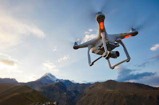
Empowering Local Heroes: Drones In COVID-19 Response

DJI Mobilizes Resources and Network to Put Drones to Work in Combatting COVID-19

As governments around the world seek effective measures to mitigate the COVID-19 pandemic, it is the first responders at the frontlines who are at high risk as they work to keep their communities safe.

Drones have quickly emerged as a vital technology for public safety agencies during this crisis as they can safely monitor public spaces, broadcast messages over loudspeakers, spot unsafe activities, create 2D and 3D maps of future testing sites or problematic locations, and provide live video from critical areas – all from a safe distance.

In support of these local heroes, DJI is activating its Disaster Relief Program to equip public safety agencies across the United States with the right equipment and support that enables our first responders to scale their UAV operations at this unprecedented time.  For more information and  program details

Tuesday, March 24, 2020

Drones Aid Foresters

Two drones are on test runs in Florida to scope out firefighters on the ground and record prescribed burns from above.  Although drones aren’t yet utilized in Nassau County, the Florida Forest Service has two drones that are sent out as part of a testing phase elsewhere in the state,...

Two drones are on test runs in Florida to scope out firefighters on the ground and record prescribed burns from above.

drone, uas, uav, forestry, florida, wildfire, wildland, fire,

Although drones aren’t yet utilized in Nassau County, the Florida Forest Service has two drones that are sent out as part of a testing phase elsewhere in the state, including Hernando County and the Withlacoochee Forestry Center, according to FFS Wildfire Mitigation Specialist Robert Chase. The project began in 2019. 

“We believe the greatest potential for use of drones in the Florida Forest Service to be in the realm of forest management activities such as prescribed fire, monitoring timber sales and surveying forest landscapes for forest health issues,” Chase said. “We anticipate using a drone for helping with ignition on prescribed burns on our state forests. There are additional attachments that we could also utilize that would allow us to do some thermal imaging. This would be helpful in our mop-up phases to see where pockets of heat may remain in a wildfire area, allowing us to better concentrate our efforts. We hope to be able to utilize a drone locally in the future for those activities.”  Read More

Monday, March 23, 2020

Drones for Search and Rescue (SAR) – Another Tool in The Toolbox


“In order to realize the true value of a drone’s capabilities, Drone Pilots and SAR authorities from the Incident Commander (IC) on down need to gain experience by employing drones on actual SAR operations and in training.  Only then will you realize that drones provide another tool in the toolbox for the Incident Commanders that can and will prove invaluable”

Drones have quickly become the most widely used tool for many industries. From Police and Fire Departments to agriculture and energy operations, drones have become essential to boosting safety and productivity.

drone, uas, uav, search and rescue, sar,

A search and rescue drone used by emergency services, such as police officers, firefighters or volunteer rescue teams, is ideal for searching over vast areas for missing persons and crime victims in need of rescue and in any environment.  Search times can be significantly reduced while limiting potential risk to the party being rescued as well as rescuers. There are many options and benefits to using drones for search and rescue.

Thermal imaging or forward-looking infrared (FLIR) is a major benefit for search and rescue. Body heat naturally makes humans stand out from plant life, making them easy to spot very quickly.  Most thermal cameras also have the option to change temperature search range and the color palette for a wide variety of options to make sure you can see exactly what you’re looking for.

Almost all commercial drones come equipped with GPS, allowing the pilot to offer rescue teams the exact GPS coordinates of the subjects once they have been spotted. With the live view feature of any drone used for search and rescue, the pilot can also guide rescue crews to their location.

There is no point sending any aircraft into the air for SAR if the visuals can’t be relayed to the ground search team or incident command as is often the case for manned aviation.  Many drones have the capability to stream live video from the controller to a monitor for on-site viewing or to a broadcast terminal to send to a remote incident command center on a larger monitor for easier identification of subjects in real-time.

This allows pilots or incident command crews to guide rescue teams to the precise location of their subjects, and the aerial view also aids in guiding those crews around any obstacles or hazards that may be in their path.

Too find out more on how you can develop a drone program for your search and rescue organization, contact Dave Crago at cragod1@gmail.com


Do you have a story of drones coming to the rescue or assisting your agency? Please share in the comments.
Drone And Life Flight Respond To Injured Woman And Family Of 4 Stranded

SANTA CLARA — Washington County Sheriff Search and Rescue responded to two calls Saturday, starting with an accident that happened on the Bear Claw Poppy trail just off Navajo Road.
Washington County Sheriff Search and Rescue Liaison Darrell Cashin told St. George News that at approximately 12:55 p.m., a man called into dispatch to report that his wife had crashed on her mountain bike and needed help.
Later Saturday evening, just before 10 p.m., the search and rescue team responded to another call of a family of four – a husband, wife and two teenage daughters with a dog – that had been hiking Red Mountain trail when it got dark. They lost their way and became stranded, Cashin said.
The search and rescue responders were sent to hike the area toward the GPS coordinates.
“We sent up our drone, located them, and just had them stay put,” he said.
Responders found them and hiked them off the mountain. No injuries were reported.
“They were fine,” he said, “just couldn’t get down, couldn’t find a way down. From the time we got the call to the time we got done was about three hours.”
With so many people out and about, Cashin said he expected to stay busy.
Do you have a story of drones coming to the rescue or assisting your agency? Please share in the comments.
Saturday, March 21, 2020

Airborne International Response Team (AIRT) Creates COVID-19 Task Force and Launches Study

This week the Airborne International Response Team (AIRT) announced two new initiatives related to the coronavirus—the creation of a task force to help fight its spread, and the launch of a study on how UAS are being used in containment efforts.

DRONERESPONDERS, the public services division of AIRT, has created a public safety UAS task force to help fight the spread of Covid-19.

The task force will be working to address potential use cases and mission planning needs that could help with containment efforts. It will also be collaborating with partners in government and private industries to provide insights on how drones can help in fighting the pandemic.

In addition to the creation of the task force, AIRT announced this week that it will be launching a research program to help identify and track operational use cases related to the COVID-19 pandemic.

Friday, March 20, 2020

GCSO delivers medicine to residents on east side of Tonto Creek

With Tonto Creek swollen because of recent rains, the Gila County Sheriff’s Office is turning to an innovative way to get medications safely across to residents. Last weekend, the GCSO, with the help of Tonto Rim Search and Rescue, sent medications via drone to two residents living on the east side of Tonto Creek.

TRSAR volunteer Brad Cole flew the drone with the medicine safely packed inside an empty peanut butter jar attached via string.  A paramedic on the other side collected the medicine and delivered it to residents. Read More
Do you have a story of drones coming to the rescue or assisting your agency? Please share in the comments.
Thursday, March 19, 2020

Public Benefits of Drone Technology

Drones have become a familiar aspect of our contemporary world. Over the past decade, they’ve graduated from expensive toys of the rich to affordable items that many of us have the opportunity to experience. They are used in photography and deliveries, and have even become the subject of their own racing events. But drones also have a vital part to play in the public sector. 
This isn’t necessarily limited to their military applications, either. Governments and public services — local and national — have begun to explore ways in which drone tech can make a real difference in our lives. Public leaders are embracing the benefits of these small aerial devices beyond the limited applications most of us are familiar with.  
Drones offer some promising solutions to some of our perennial public challenges. We’ll take a look at a few key areas in which they’re already starting to make a difference across various community issues. How are they being used, and what innovations do they offer?  Read More

drone, uas, uav, public, safety,

Wednesday, March 18, 2020

Multiple crews – and a drone – combine forces to rescue 2 hikers hours apart in Red Cliffs Reserve

ST. GEORGE — Two separate rescue operations in the Red Cliffs Desert Reserve kept emergency personnel, flight crews and search and rescue teams busy until late Tuesday night.
The first rescue was called in shortly after noon when a hiker suffered a fractured ankle while hiking the Church Rocks loop near Exit 13, a slickrock trail about 2.6 miles in length that rises to an elevation of more than 185 feet from the wash to the highest point on the ridge in the reserve.
The woman was hiking with a group who called 911 for help.
Washington City Police, as well as Washington City and Hurricane Valley Fire responded with ATVs to search for the injured hiker. Washington County Sheriff’s Sgt. Darrell Cashin said Washington County Search and Rescue was also called in to conduct a ground search, and Intermountain Life Flight was launched to provide aerial assistance.  Read More
Do you have a story of drones coming to the rescue or assisting your agency? Please share in the comments.
Tuesday, March 17, 2020

Dye-dropping DJI Mavic 2 drones to help stop drownings in Australia

drone, uas, uav, search, rescue, sar, ocean water, public safety,

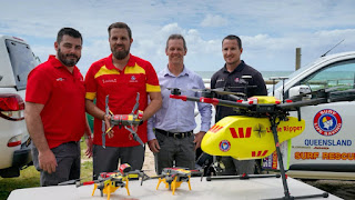
In Australia, the Westpac Life Saver Rescue Drone program has commissioned a number of dye-dropping DJI Mavic 2 drones, that can drop sea marker dye into the ocean that allows lifesavers on the beach to more easily spot riptides and help stop drownings. Read more 


Do you have a story of drones coming to the rescue or assisting your agency? Please share in the comments.

Friday, March 6, 2020

Tampa Fire Rescue using drone technology to improve safety in emergency situations

TAMPA, Fla. -- The Tampa Fire Rescue is launching a new tool to help improve safety in emergency situations.

The agency has purchased two drones, using the equipment for the first time this week.

"It’s really a force multiplier when it comes to manpower. The information that these systems provides pertain to almost every asset of what we do in the fire service," said Captain John Bogush with special operations at Tampa Fire Rescue.  Continue Reading

Thursday, March 5, 2020

How are drones used in search and rescue - Pix4D Interview


Gene Robinson, the “grandfather of search and rescue drone operations” sat down with Pix4D to discuss the view from aerial SAR.

For over a decade, Gene Robinson has been a leading expert in drones for search and rescue. Robinson sat down with Pix4D’s Angad Singh, to discuss all things aerial. 

Pix4D: Thank you for agreeing to talk to us today, Gene! Let’s begin at the beginning: What is search and rescue?

Robinson: Search and Rescue - SAR - is a service that is provided across Public Safety agencies. It has historically been the purview of fire departments, but now a team can be made up of specialists within a municipal police department, or a county sheriff’s department or even an Office of Emergency Management, or OEM, at the county level.

The emergence of private SAR teams such as TEXSAR and Texas Equusearch in the United States, has bolstered the capabilities of any local agency requiring that skill set or expertise they may not have. Additionally, because private SAR organizations are operated on donations, they may specialize in a certain field such as drones, boats, dogs, or foot searchers that utilize the latest of technologies to perform searches. Read the complete interview here

Another post on Water Rescues Thanks To Drone Mapping

Do you have a story of drones coming to the rescue or assisting your agency? Please share in the comments.